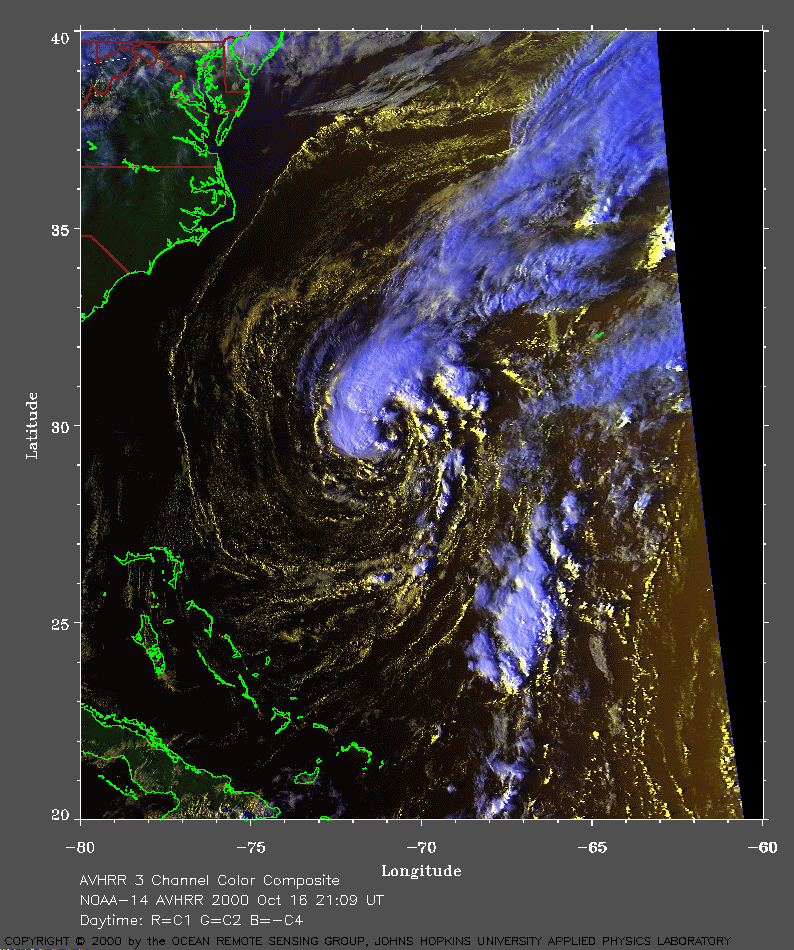
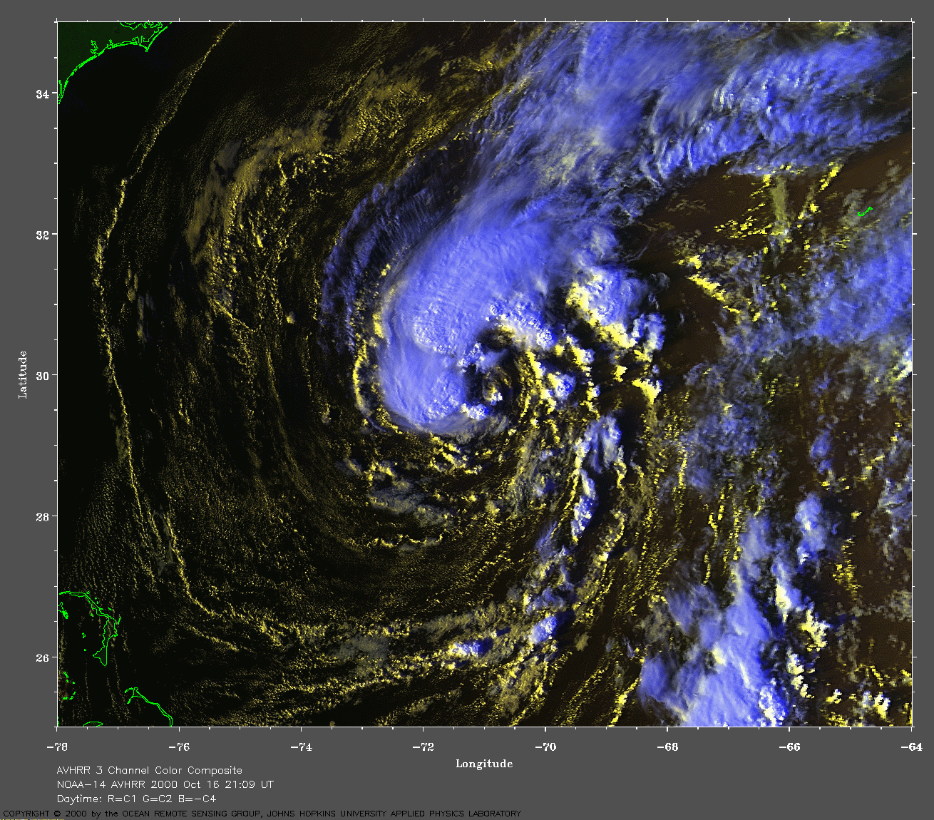
 2000 October 16 21:09 UT
NOAA-14 satellite AVHRR 3 channel color composite afternoon image.
A closer view (319 Kb) is seen by clicking on this small image.
The maximum sustained winds are 35 mph.
A very large image
(779 Kb) is also available.
Note the island of Bermuda (J-shaped) on the right side of this image.
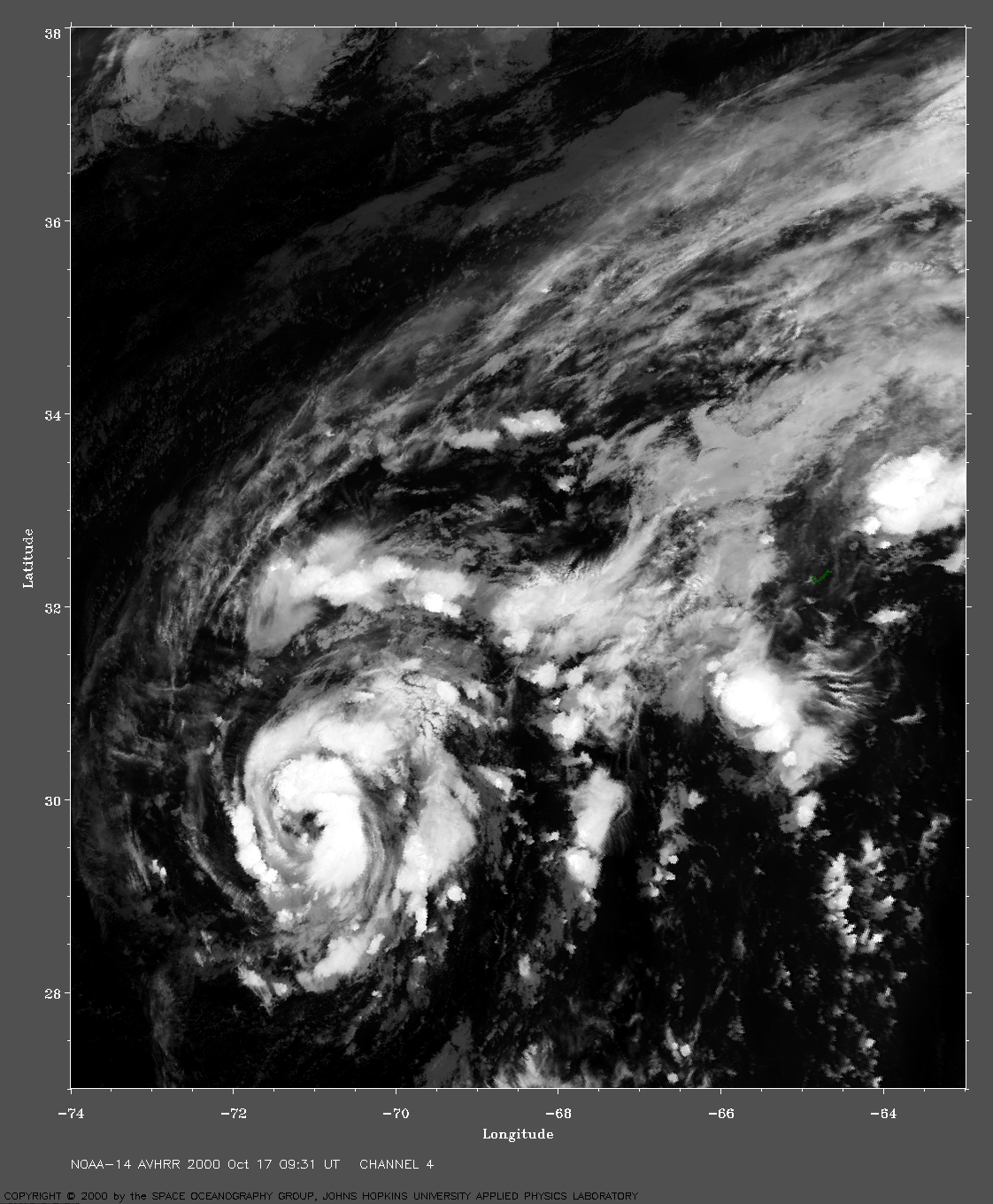
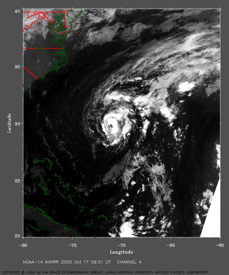 2000 October 17 09:31 UT
NOAA-14 satellite AVHRR channel 4 early morning image.
A closer view (478 Kb) is seen by clicking on this small image.
The maximum sustained winds have increased to 40 mph.
A very large image
(1082 Kb) is also available.
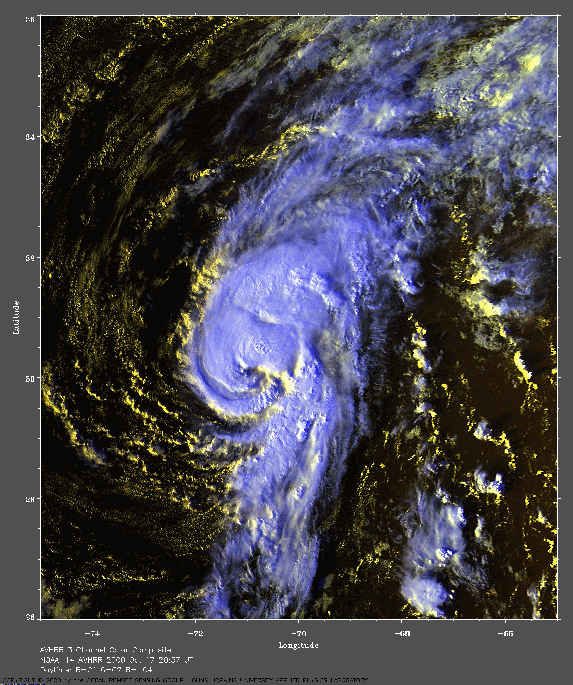
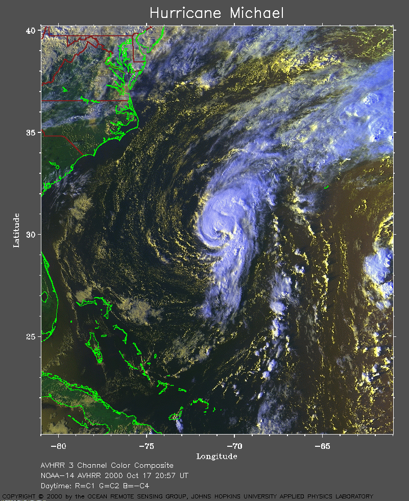 2000 October 17 20:57 UT
NOAA-14 satellite AVHRR 3 channel color composite afternoon image.
A closer view (445 Kb) is seen by clicking on this small image.
The maximum sustained winds are increasing from 50 mph at 15:00 UT to 75
mph at 21:00 UT, making Michael a hurricane.
A very large image
(808 Kb) is also available.
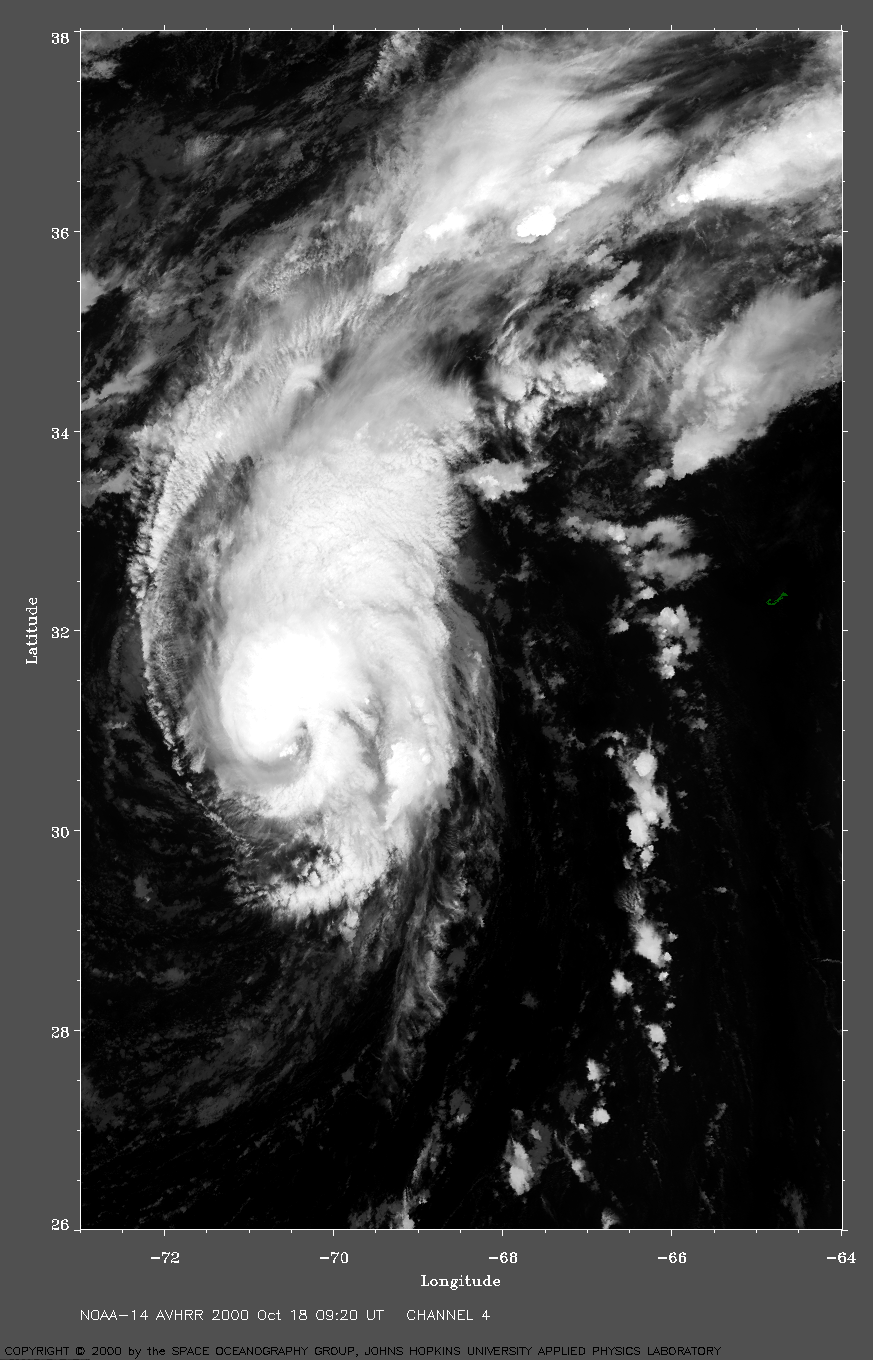
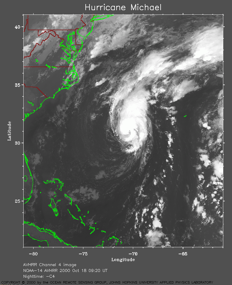 2000 October 18 09:20 UT
NOAA-14 satellite AVHRR channel 4 morning image.
A closer view (290 Kb) is seen by clicking on this small image.
A very large image
(759 Kb) is also available.
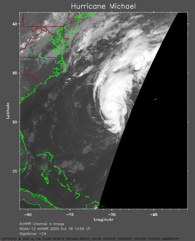 2000 October 18 10:55 UT
NOAA-12 satellite AVHRR channel 4 morning image.
A closer view (198 Kb) is seen by clicking on this small image.
A very large image
(600 Kb) is also available.
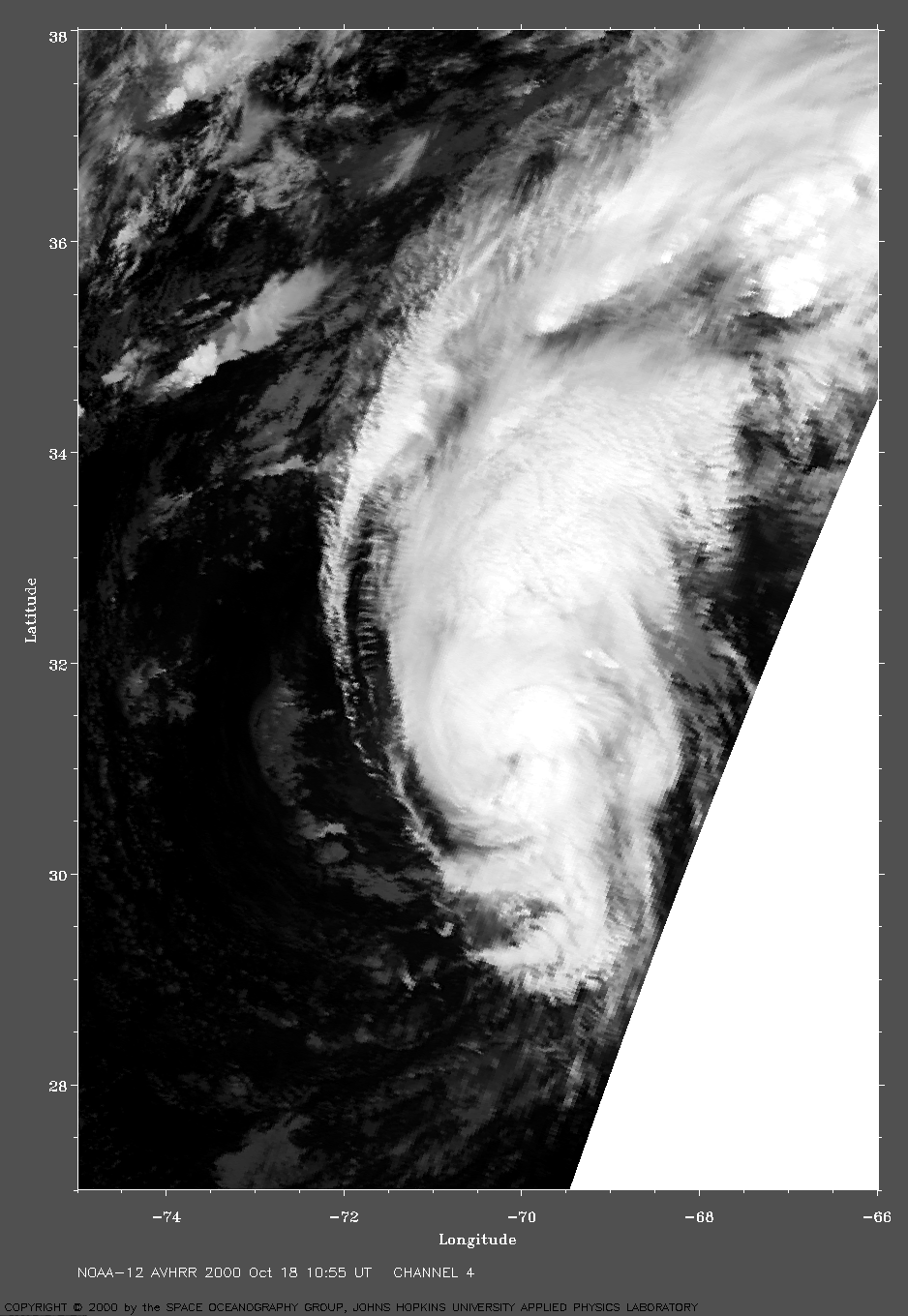
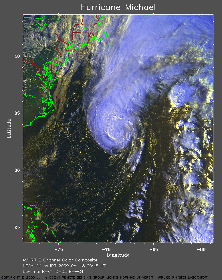 2000 October 18 20:45 UT
NOAA-14 satellite AVHRR 3 channel color composite afternoon image.
A closer view (417 Kb) is seen by clicking on this small image.
The maximum sustained winds are increasing to 85 mph at 21:00 UT.
A very large image
(742 Kb) is also available.
Note the island of Bermuda (J-shaped) near latitude 32 N, longitude 64 W.
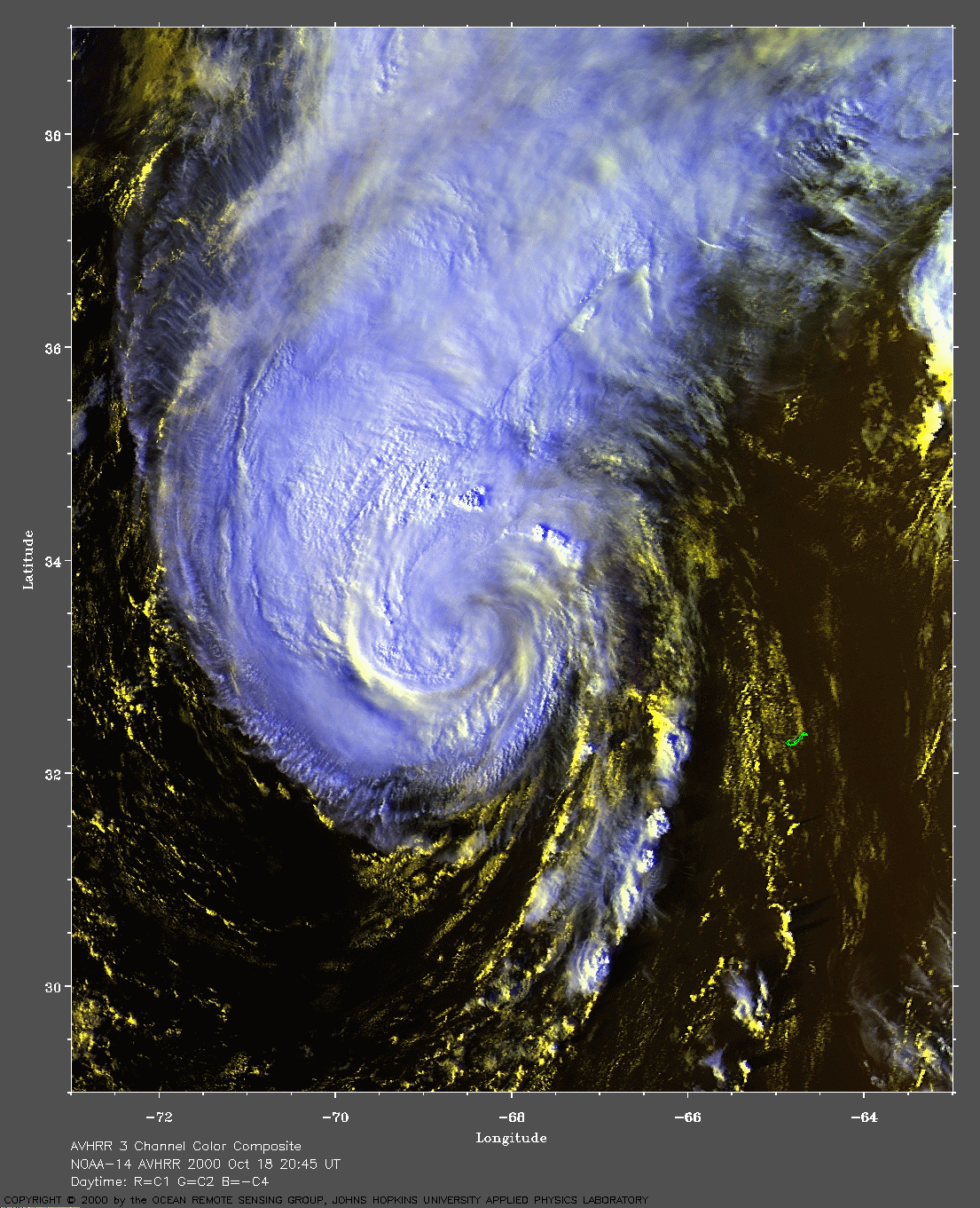
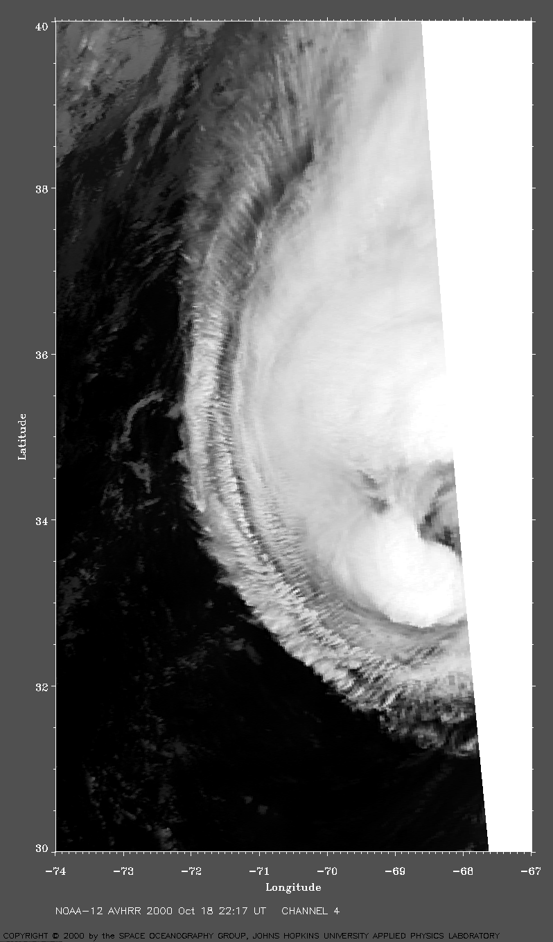
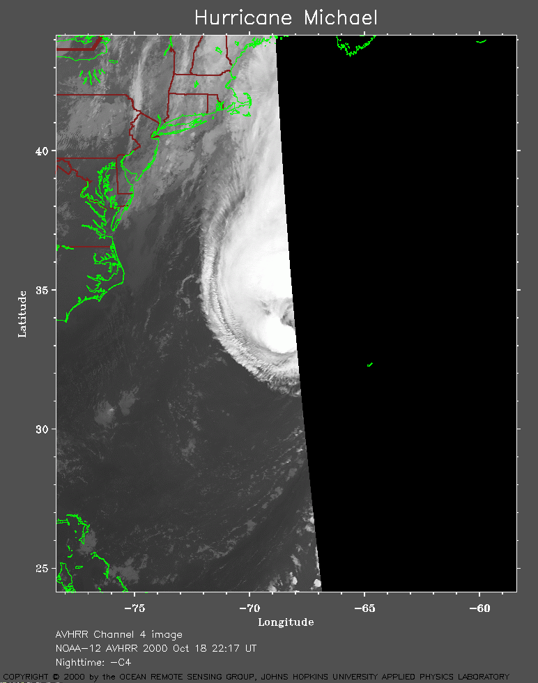 2000 October 18 22:17 UT
NOAA-12 satellite AVHRR channel 4 nighttime image.
A closer view (139 Kb) is seen by clicking on this small image.
A very large image
(313 Kb) is also available.
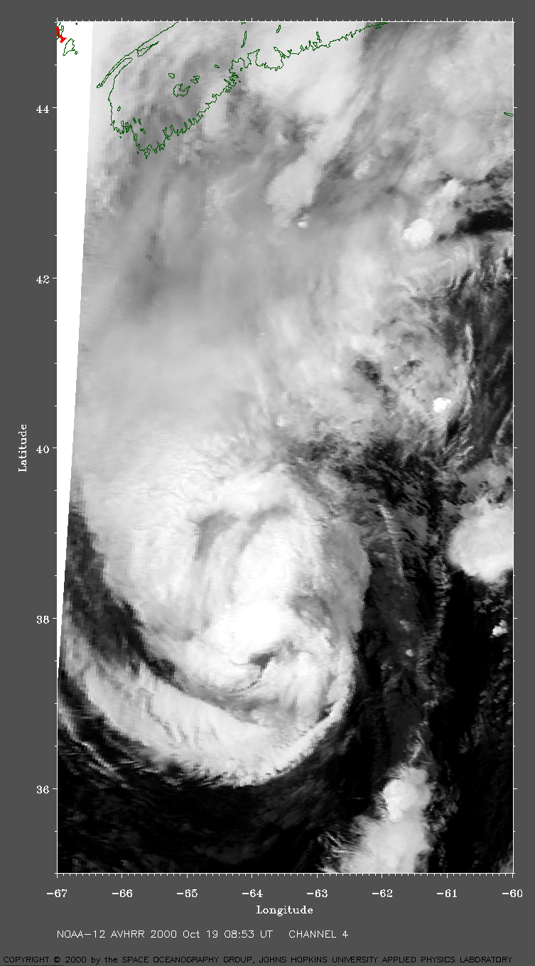
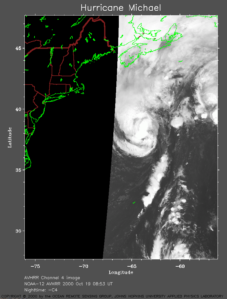 2000 October 19 08:53 UT
NOAA-12 satellite AVHRR channel 4 early morning image.
A closer view (162 Kb) is seen by clicking on this small image.
A very large image
(396 Kb) is also available.
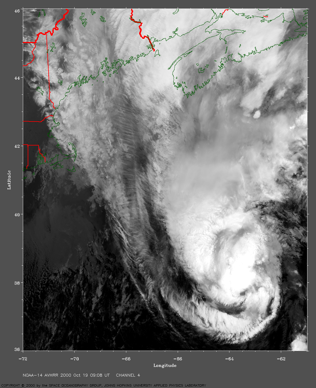
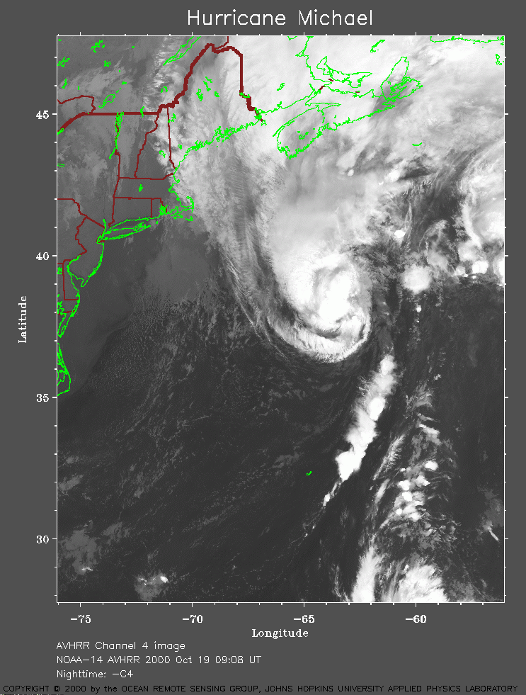 2000 October 19 09:08 UT
NOAA-14 satellite AVHRR channel 4 early morning image.
A closer view (267 Kb) is seen by clicking on this small image.
A very large image
(1057 Kb) is also available.
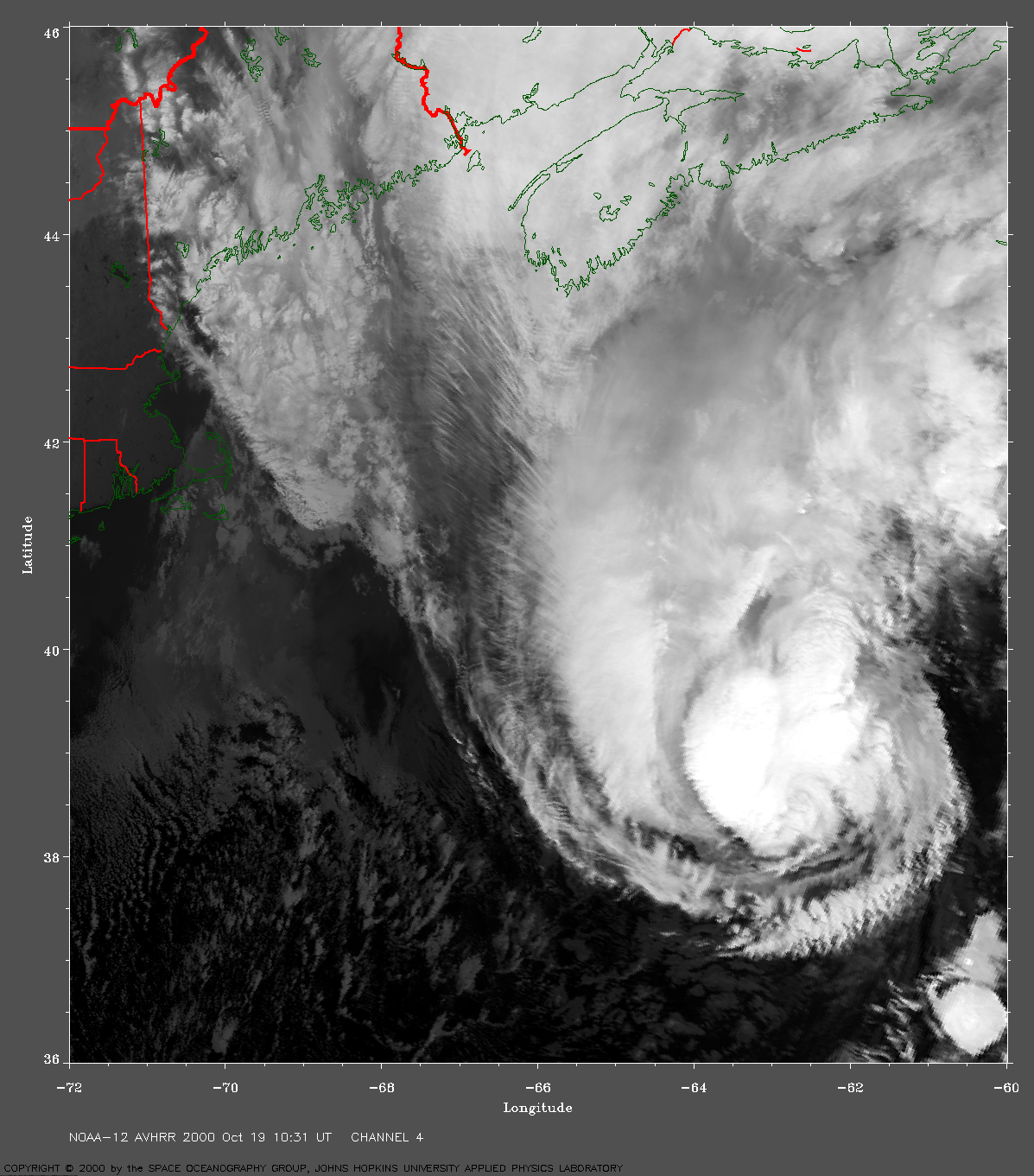
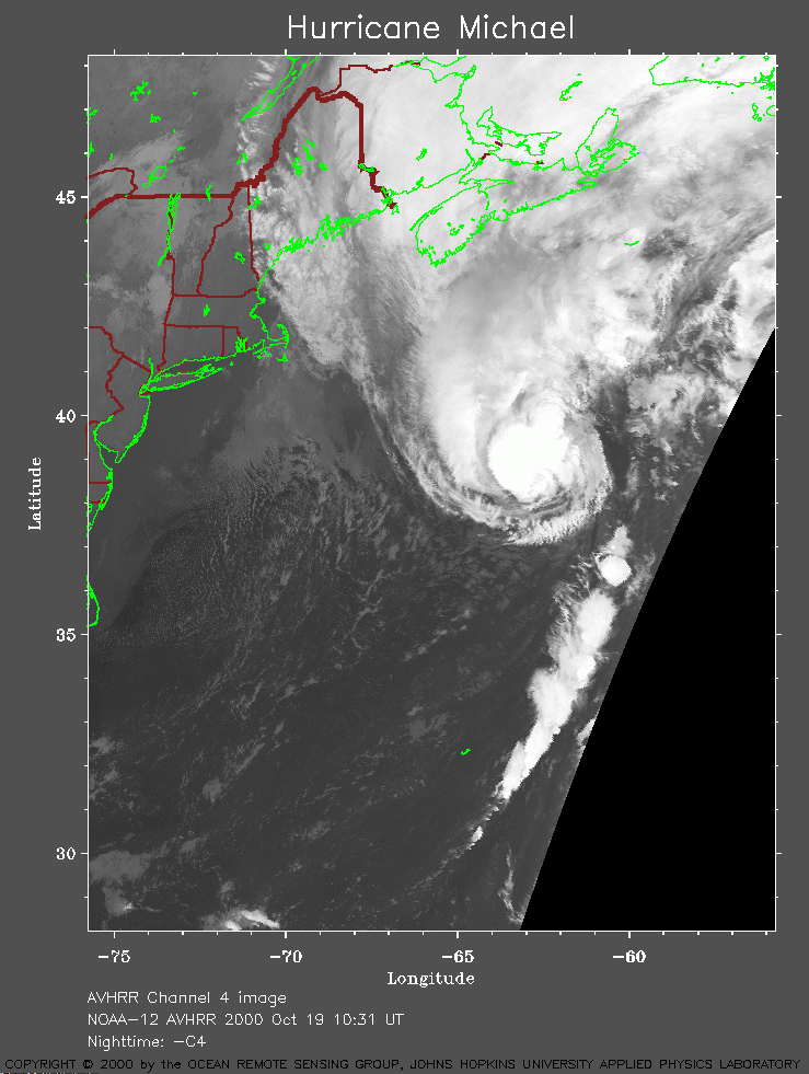 2000 October 19 10:31 UT
NOAA-12 satellite AVHRR channel 4 morning image.
A closer view (230 Kb) is seen by clicking on this small image.
A very large image
(1028 Kb) is also available.
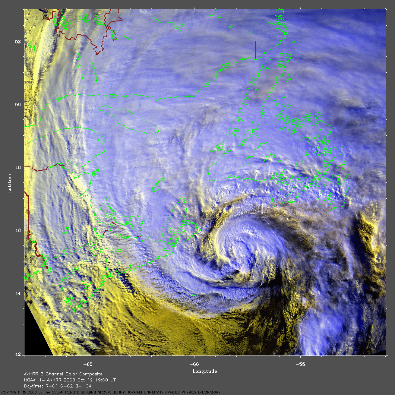
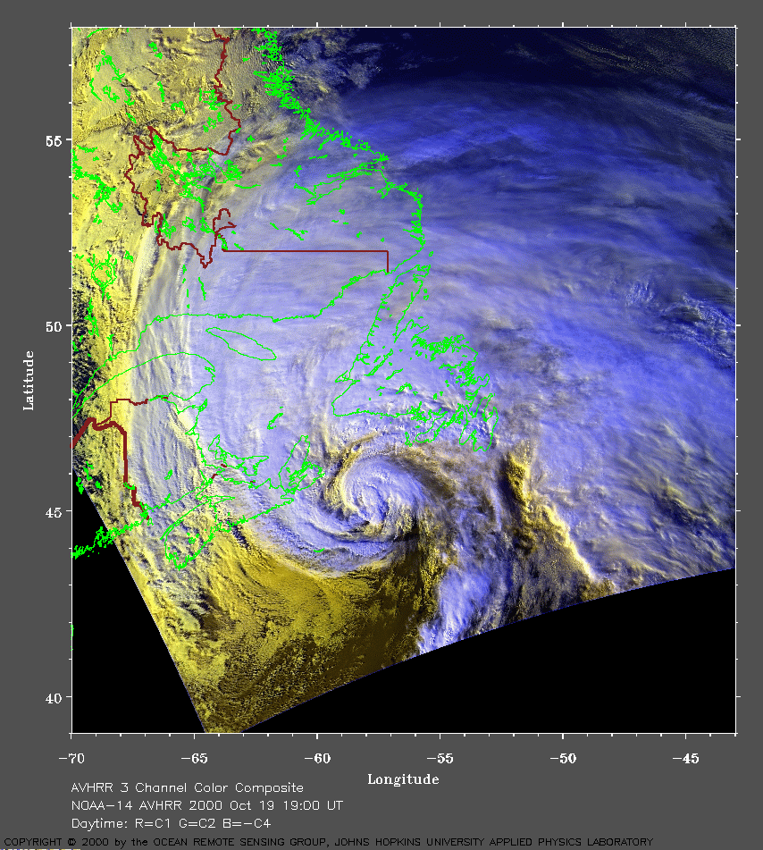 2000 October 19 19:00 UT
NOAA-14 satellite AVHRR 3 channel color composite afternoon image.
A closer view (394 Kb) is seen by clicking on this small image.
Based on a ship report, the maximum sustained winds have increased to
100 mph.
A very large image
(986 Kb) is also available.
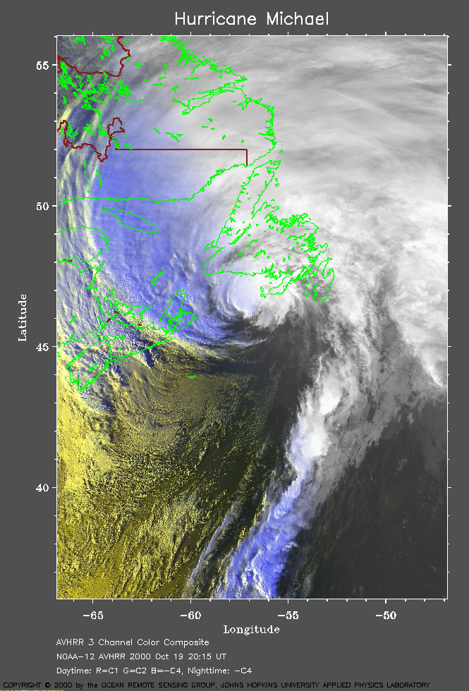 2000 October 19 20:15 UT
NOAA-12 satellite AVHRR 3 channel color composite evening image.
A closer view (295 Kb) is seen by clicking on this small image.
A very large image
(891 Kb) is also available.
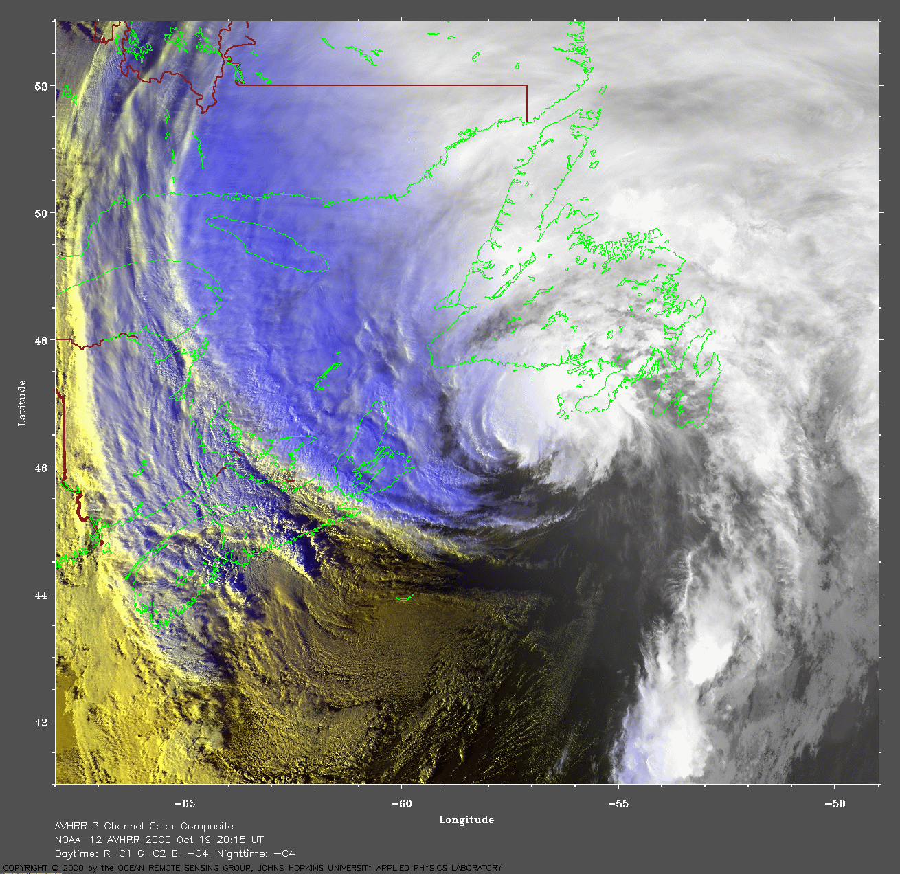
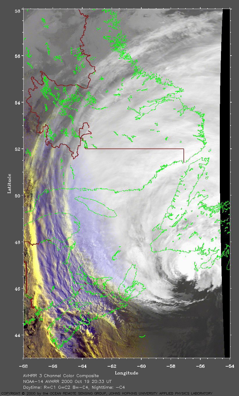
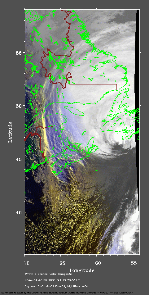 2000 October 19 20:33 UT
NOAA-14 satellite AVHRR 3 channel color composite evening image.
A closer view (192 Kb) is seen by clicking on this small image.
Michael is about to make landfall on Newfoundland and has maximum
sustained winds of 100 mph.
A very large image
(407 Kb) is also available.
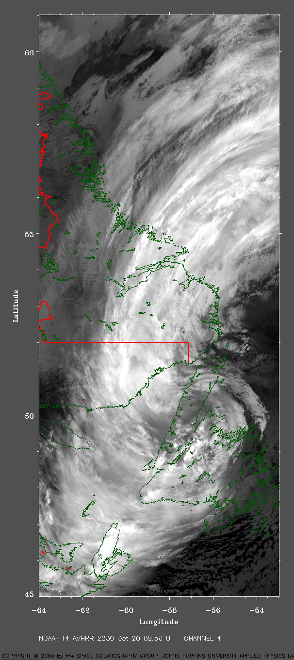
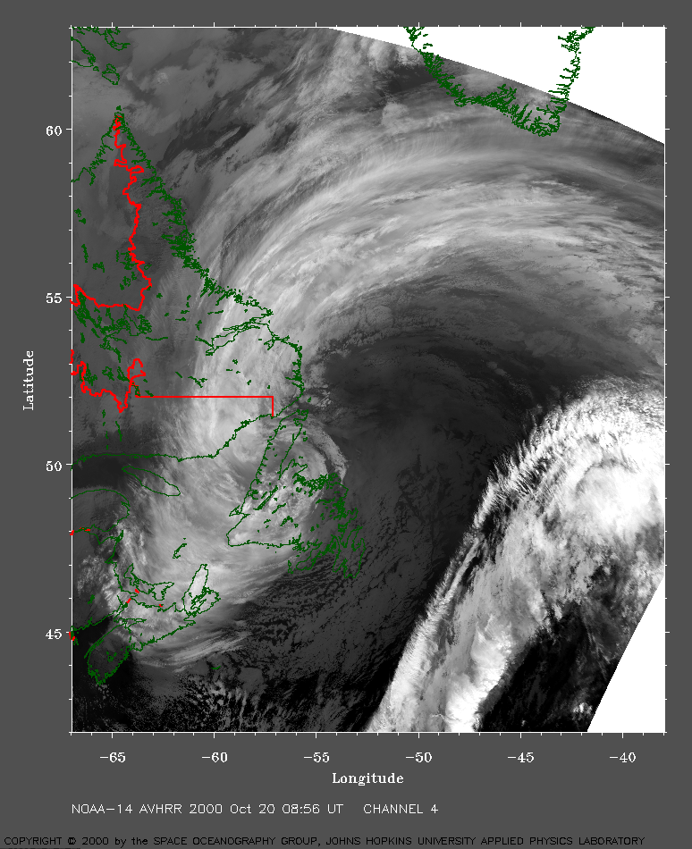 2000 October 20 08:56 UT
NOAA-14 satellite AVHRR channel 4 early morning image.
A closer view (487 Kb) is seen by clicking on this small image.
Michael is now the extratropical system located over Newfoundland.
A very large image
(604 Kb) is also available.