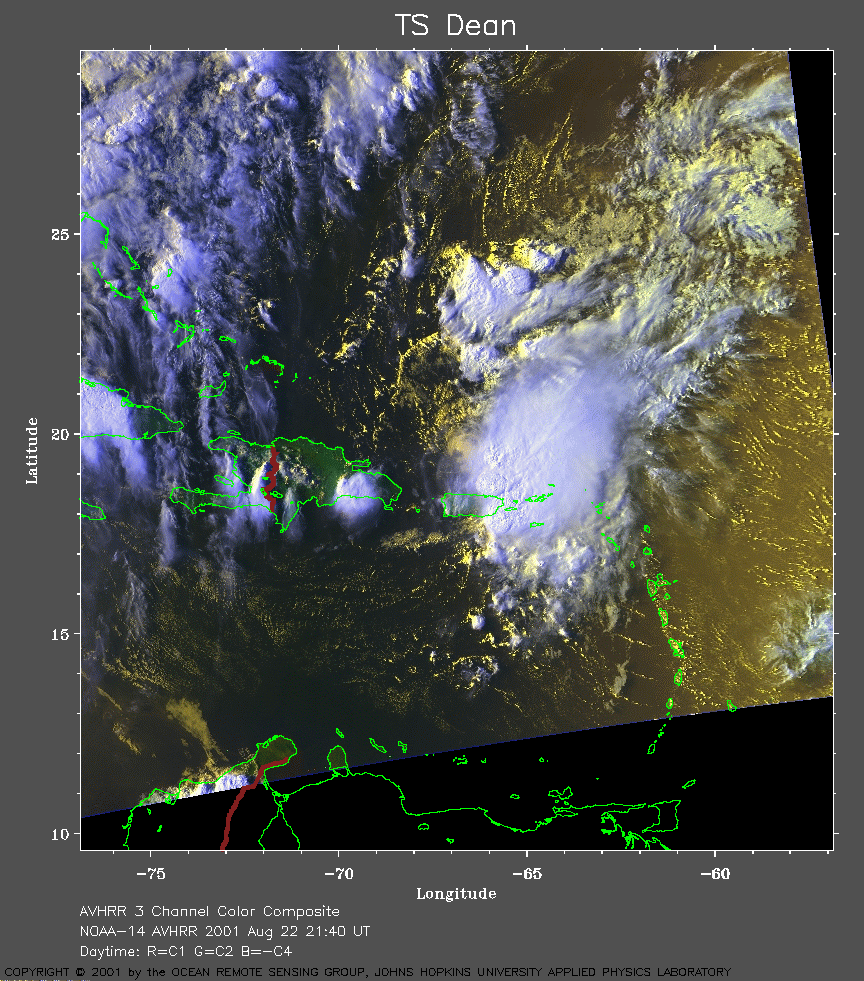
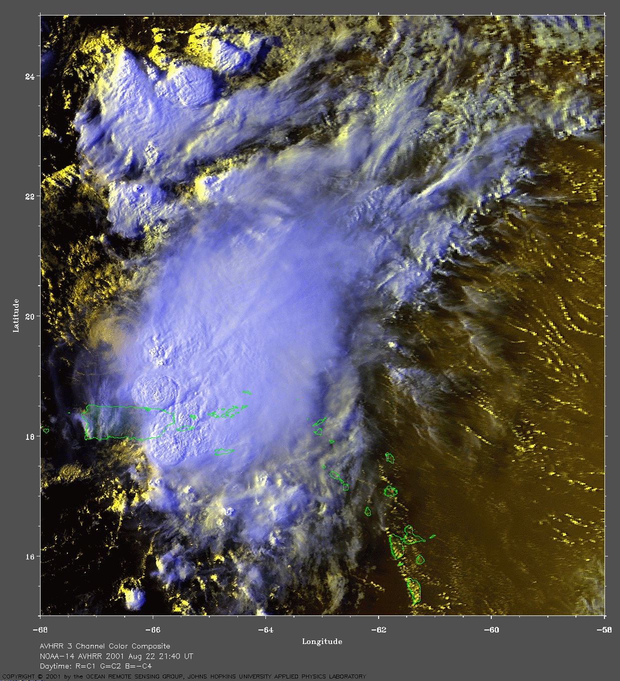
 2001 August 22 21:40 UT
NOAA-14 satellite AVHRR 3 channel color composite early evening image.
A closer view (422 Kb) is seen by clicking on this small image.
A very large image
(877 Kb) is also available.
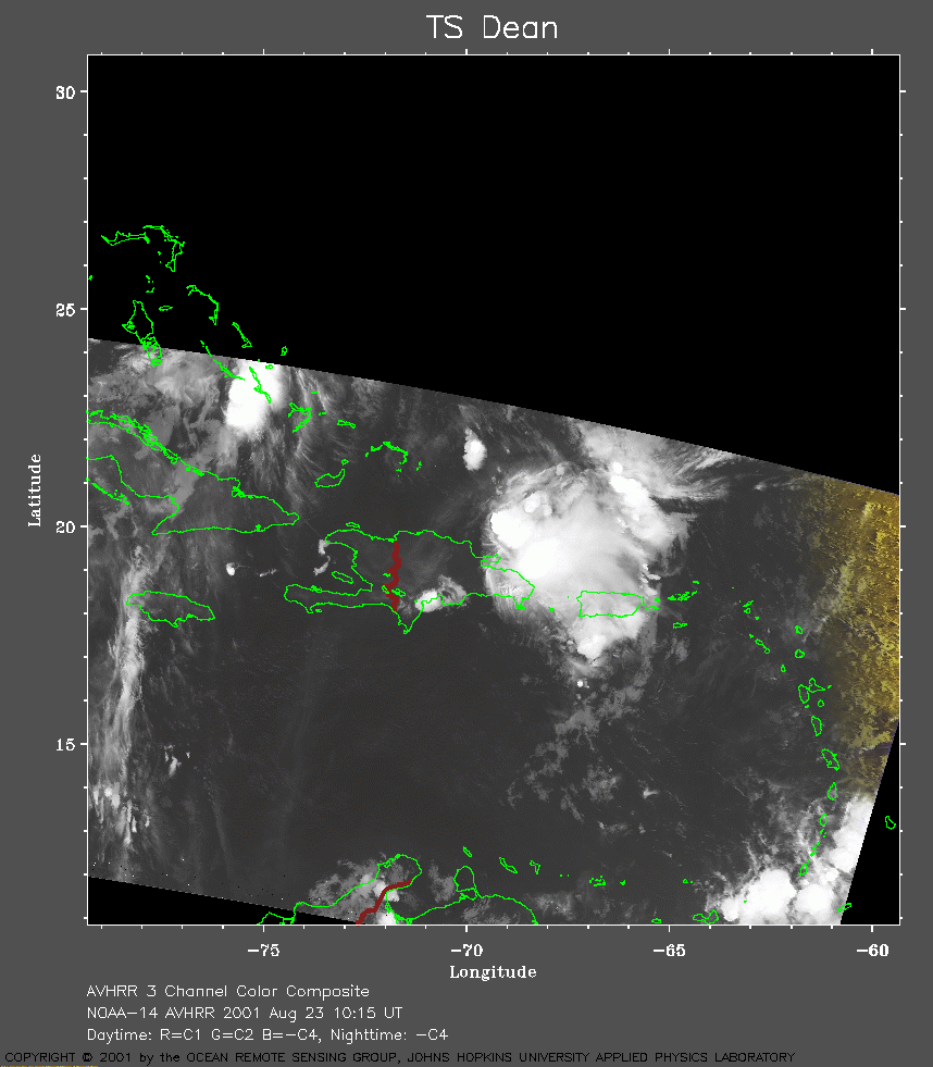 2001 August 23 10:15 UT
NOAA-14 satellite AVHRR channel 4 early morning image.
A closer view (157 Kb) is seen by clicking on this small image.
A very large image
(747 Kb) is also available.
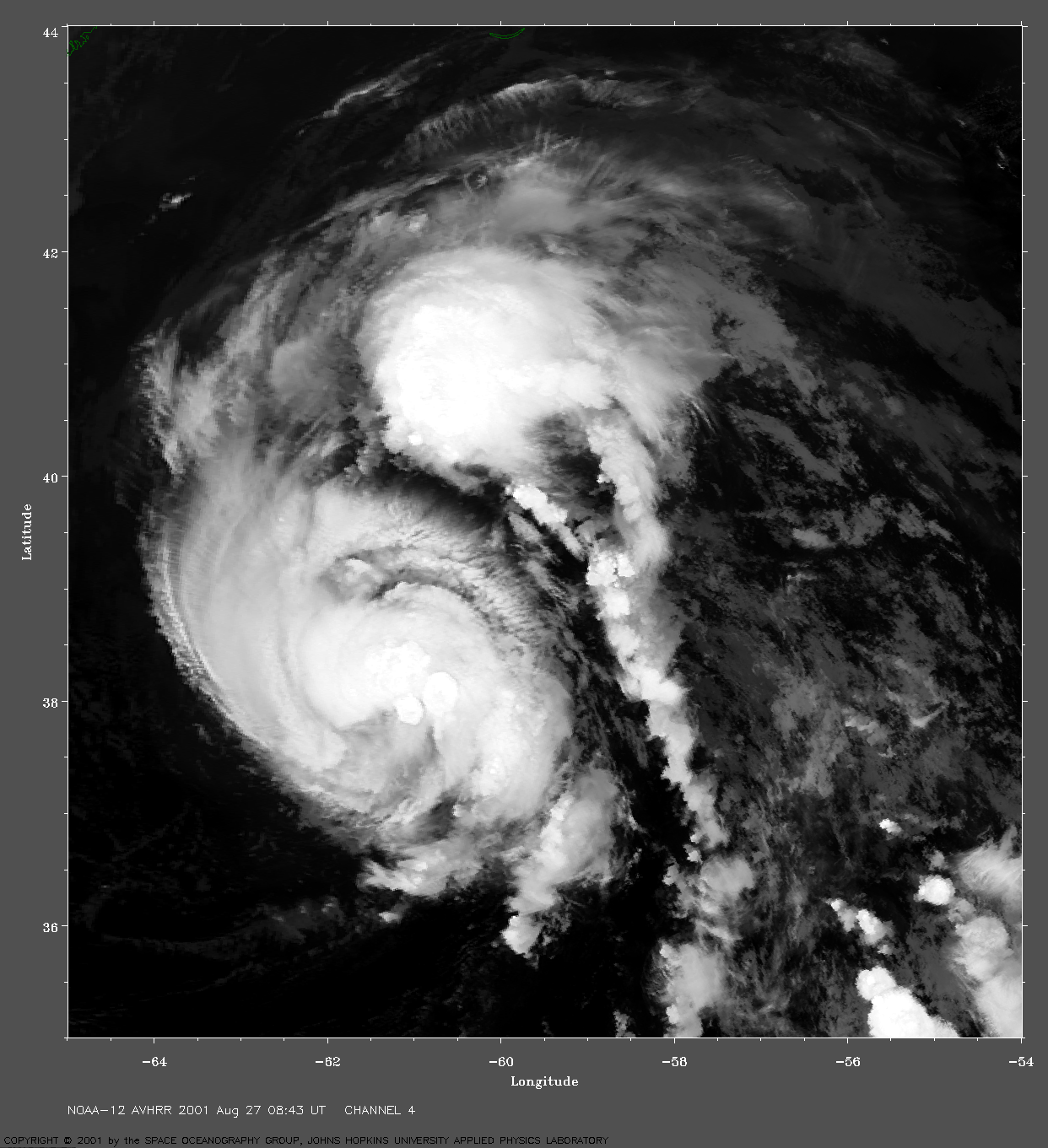
 2001 August 27 08:43 UT
NOAA-12 satellite AVHRR channel 4 early morning image.
A closer view (477 Kb) is seen by clicking on this small image.
Dean re-developed over the warm water of the Gulf Stream with 60
mph winds at 09:00 UT.
A very large image
(890 Kb) is also available.
 2001 August 27 09:15 UT
NOAA-14 satellite AVHRR channel 4 early morning image.
A closer view (315 Kb) is seen by clicking on this small image.
A very large image
(911 Kb) is also available.
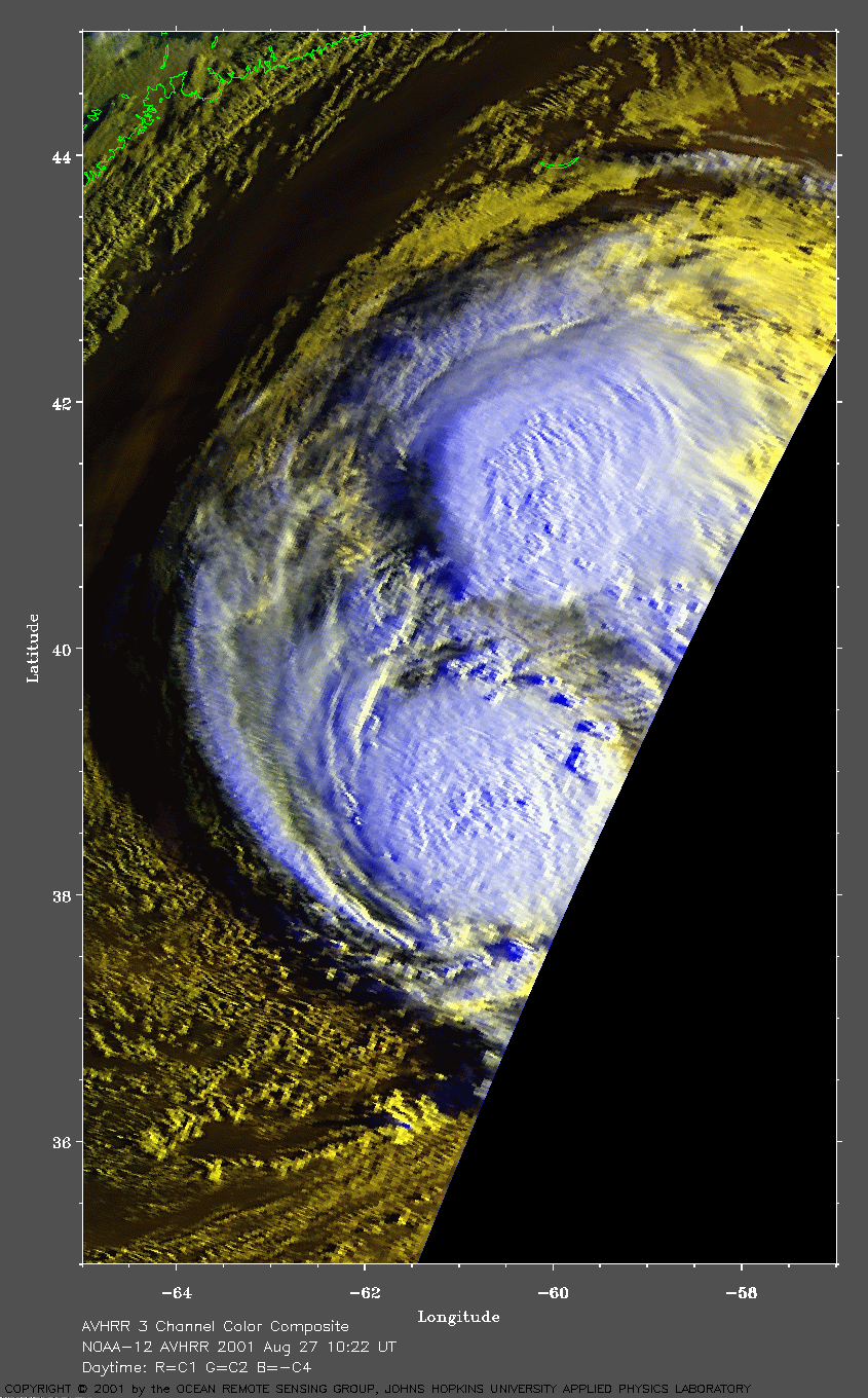
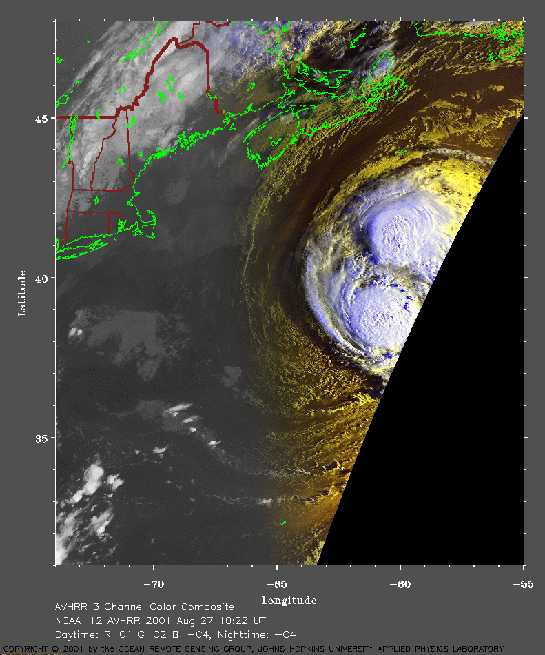 2001 August 27 10:22 UT
NOAA-12 satellite AVHRR 3 channel color composite morning image.
A closer view (284 Kb) is seen by clicking on this small image.
A very large image
(482 Kb) is also available.
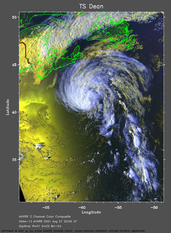 2001 August 27 20:05 UT
NOAA-12 satellite AVHRR 3 channel color composite afternoon image.
A closer view (391 Kb) is seen by clicking on this small image.
The maximum sustained winds are increasing from 65 mph at 15:00 UT to 70
mph at 21:00 UT.
A very large image
(979 Kb) is also available.
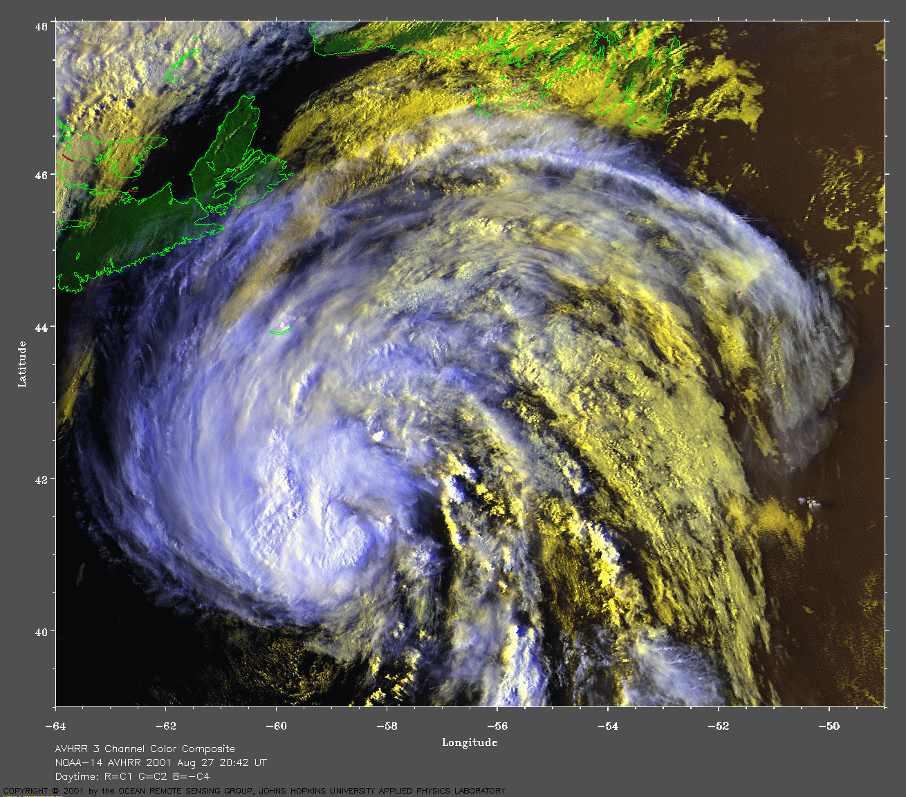
 2001 August 27 20:42 UT
NOAA-14 satellite AVHRR 3 channel color composite morning image.
A closer view (381 Kb) is seen by clicking on this small image.
A very large image
(887 Kb) is also available.
 2001 August 28 09:04 UT
NOAA-14 satellite AVHRR channel 4 early morning image.
A closer view (224 Kb) is seen by clicking on this small image.
The maximum sustained winds decreased to 65 mph at 09:00 UT as Dean
began moving over cooler water.
A very large image
(898 Kb) is also available.
 2001 August 28 09:59 UT
NOAA-12 satellite AVHRR 3 channel color composite morning image.
A closer view (306 Kb) is seen by clicking on this small image.
The maximum sustained winds are decreasing from 65 mph at 09:00 UT to 60
mph at 15:00 and Dean is becoming extra-tropical.
A very large image
(692 Kb) is also available.