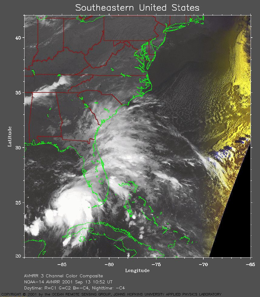
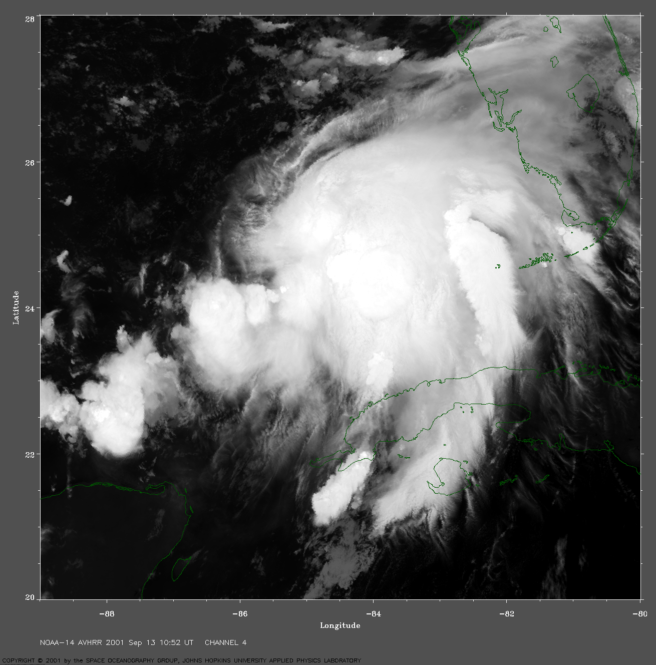
 2001 September 13 10:52 UT
NOAA-14 satellite AVHRR channel 4 early morning image.
A closer view (283 Kb) is seen by clicking on this small image.
At this time, Gabrielle is not yet a tropical storm but will be declared
one at 15:00 UT when the maximum sustained winds reach 45 mph.
A very large image
(1018 Kb) is also available.
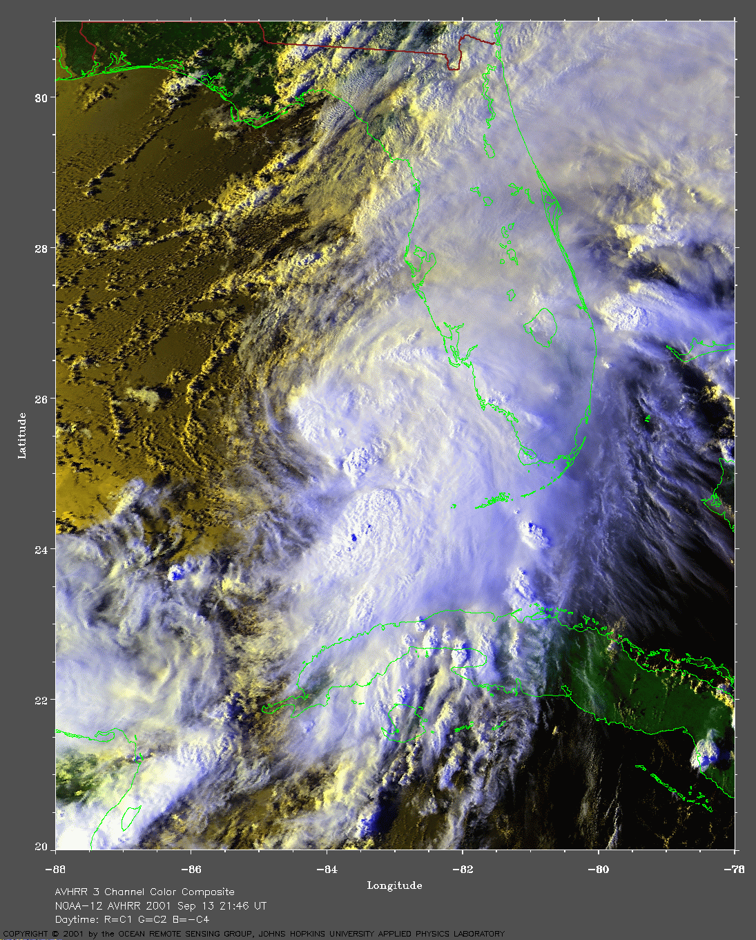
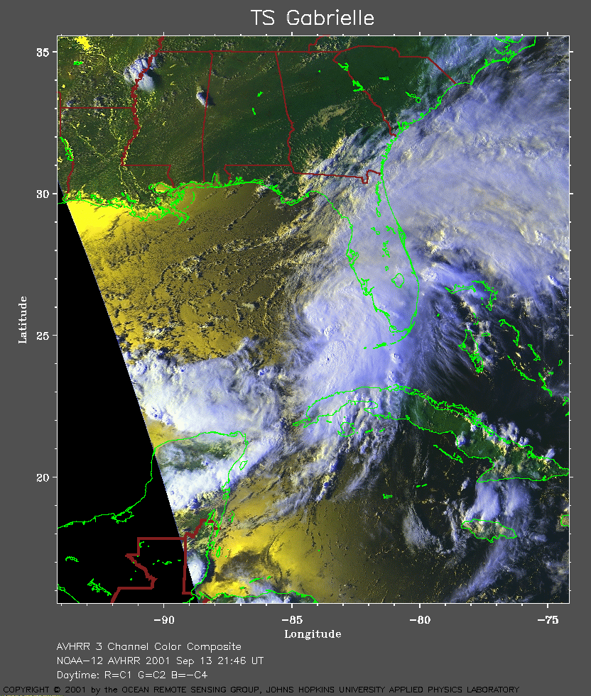 2001 September 13 21:46 UT
NOAA-12 satellite AVHRR 3 channel color composite evening image.
A closer view (406 Kb) is seen by clicking on this small image.
Gabrielle is a tropical storm with maximum sustained winds of 50 mph.
A very large image
(837 Kb) is also available.
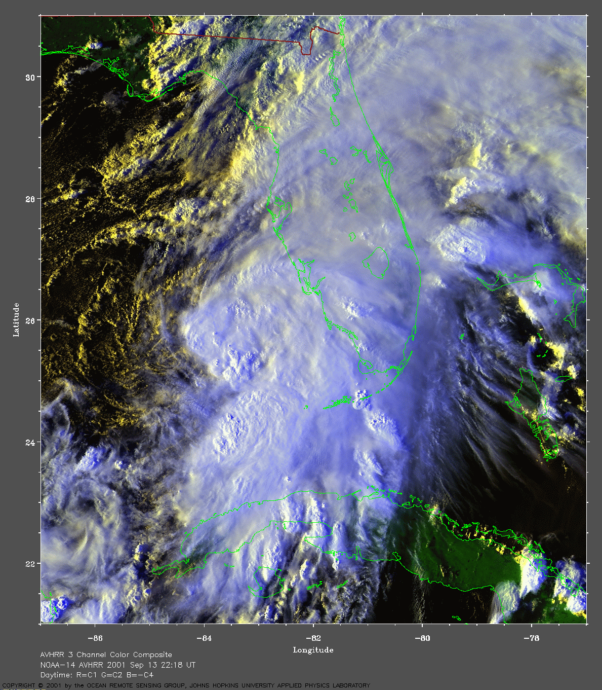
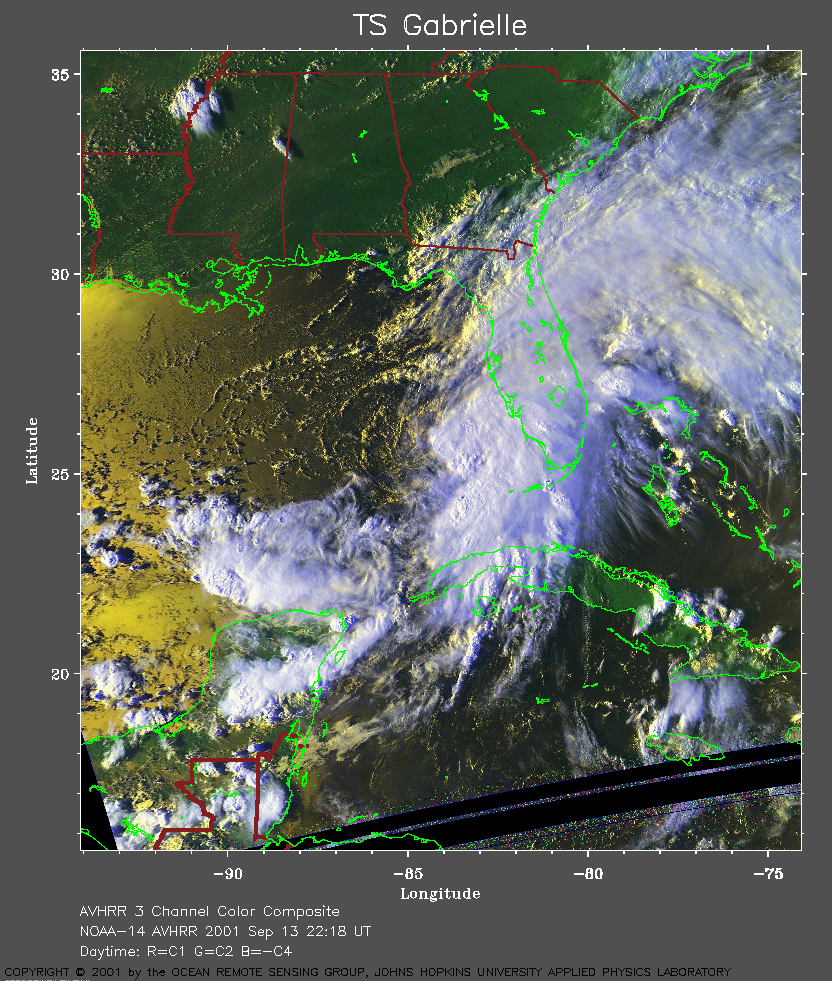 2001 September 13 22:18 UT
NOAA-14 satellite AVHRR 3 channel color composite evening image.
A closer view (427 Kb) is seen by clicking on this small image.
The maximum sustained winds increased to 50 mph at 21:00 UT.
A very large image
(873 Kb) is also available.
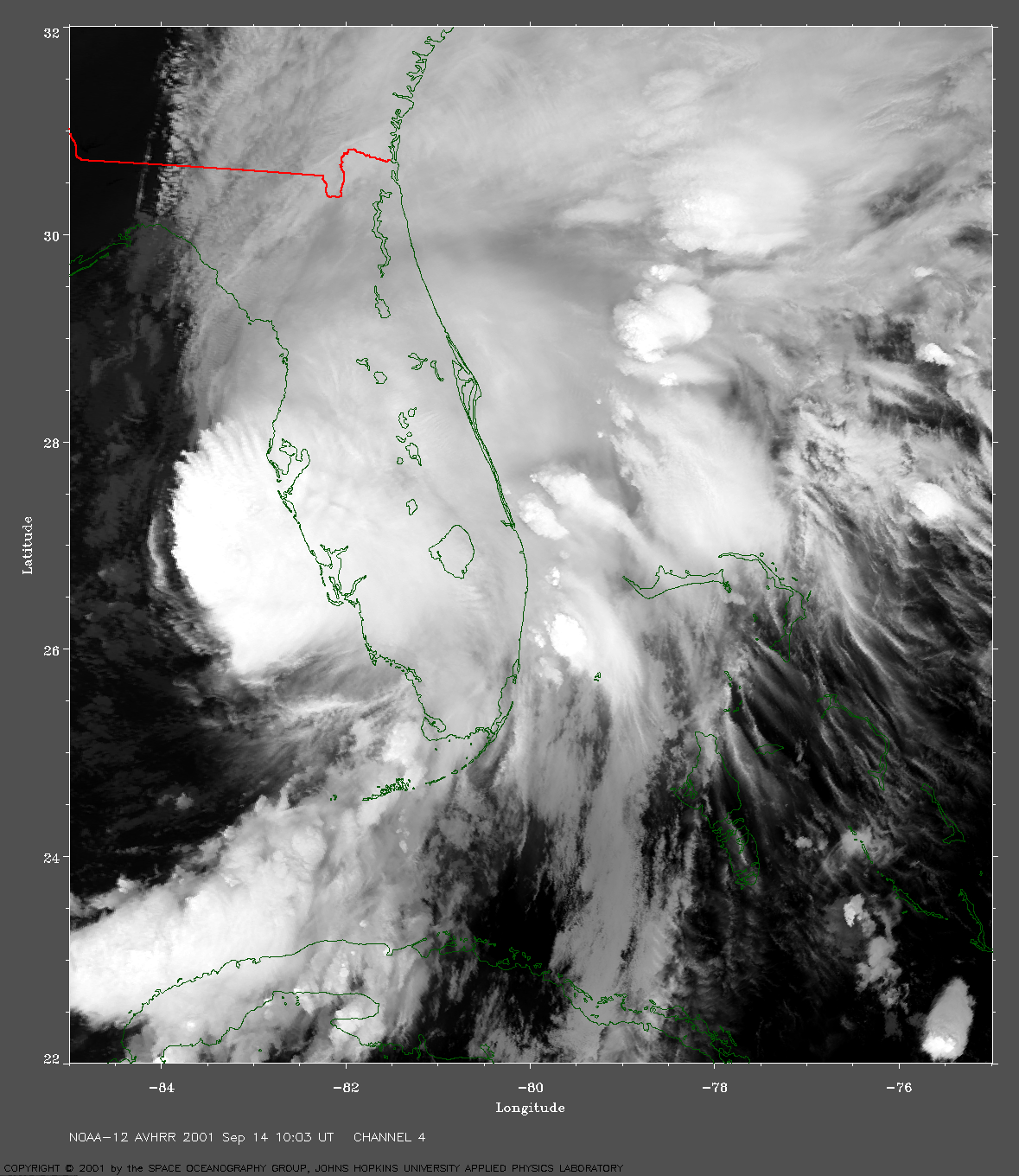
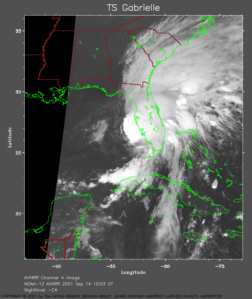 2001 September 14 10:03 UT
NOAA-12 satellite AVHRR channel 4 early morning image.
A closer view (264 Kb) is seen by clicking on this small image.
The maximum sustained winds increased to 70 mph at 09:00 UT.
A very large image
(1037 Kb) is also available.
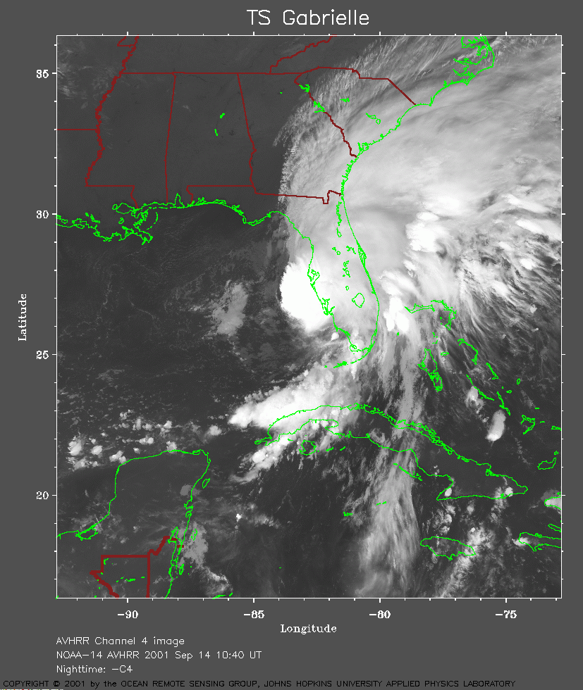 2001 September 14 10:40 UT
NOAA-14 satellite AVHRR channel 4 early morning image.
A closer view (292 Kb) is seen by clicking on this small image.
A very large image
(1167 Kb) is also available.
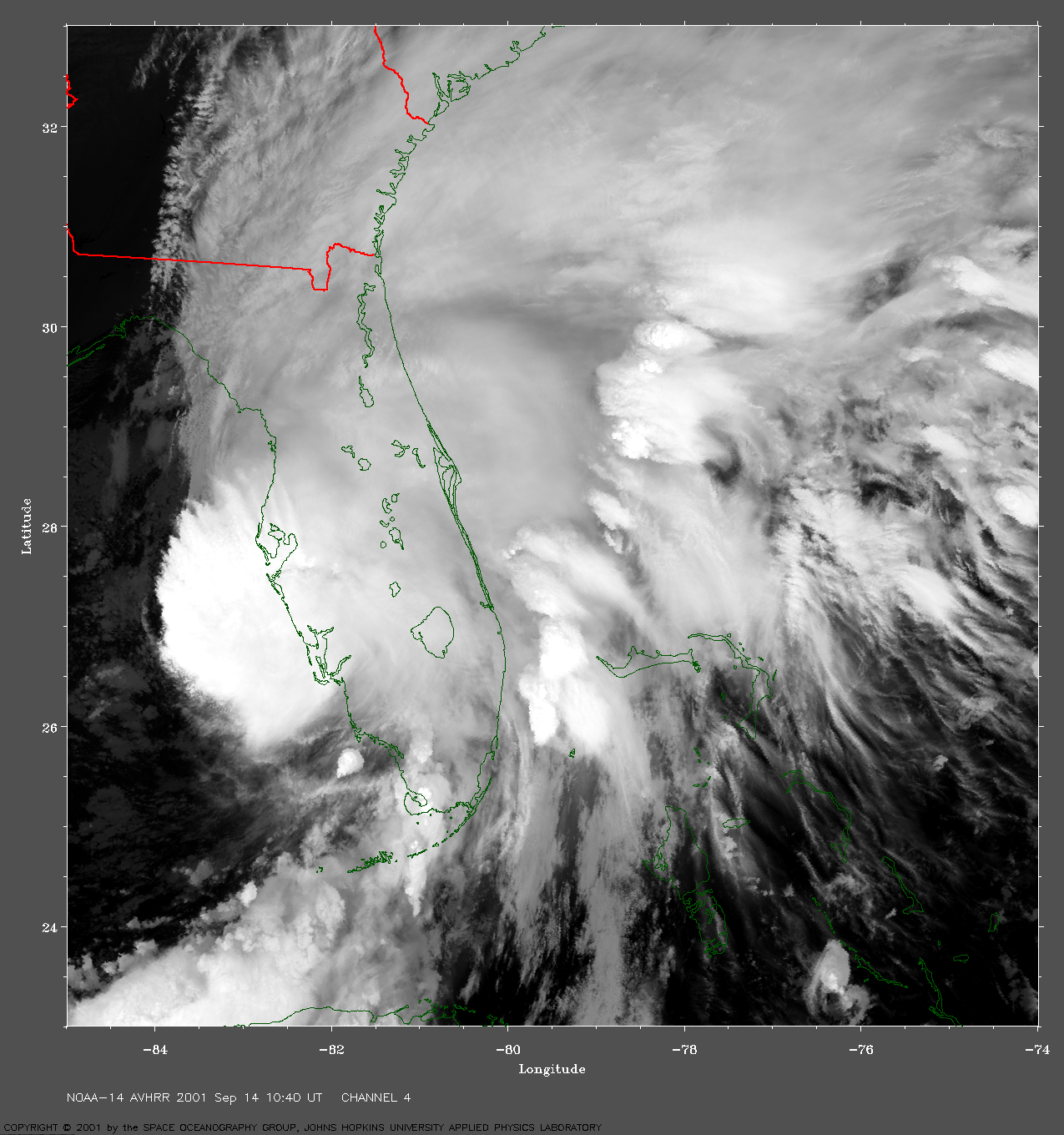
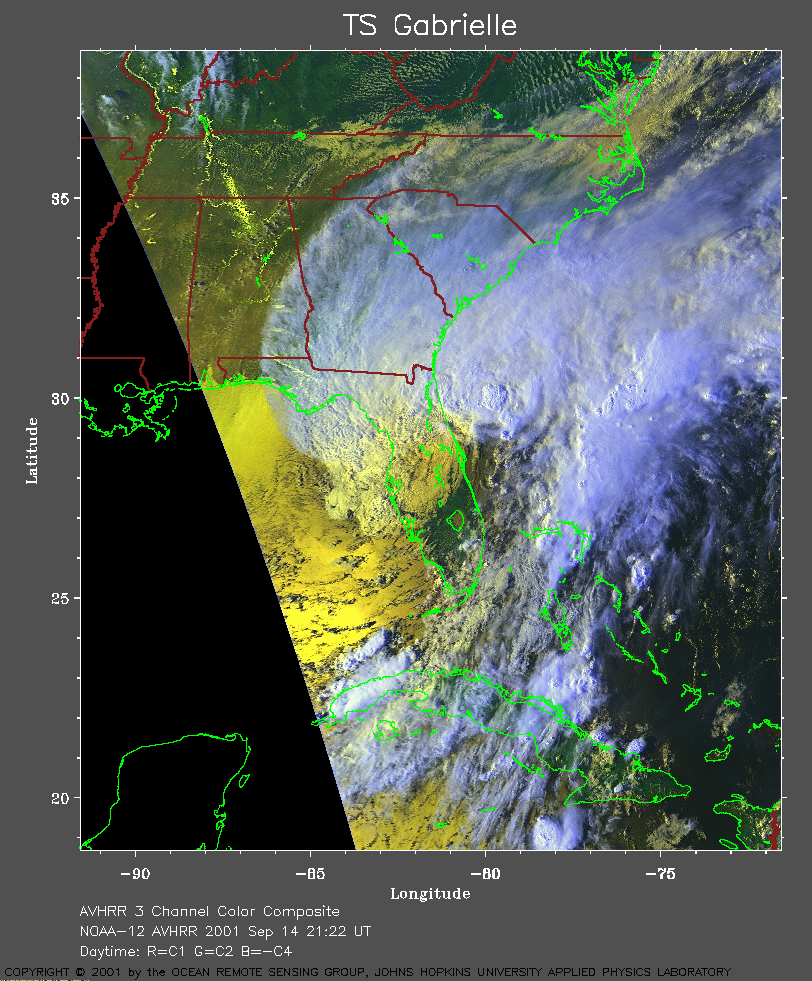 2001 September 14 21:22 UT
NOAA-12 satellite AVHRR 3 channel color composite evening image.
A closer view (367 Kb) is seen by clicking on this small image.
The maximum sustained winds decreased to 45 mph at 21:00 UT.
A very large image
(895 Kb) is also available.
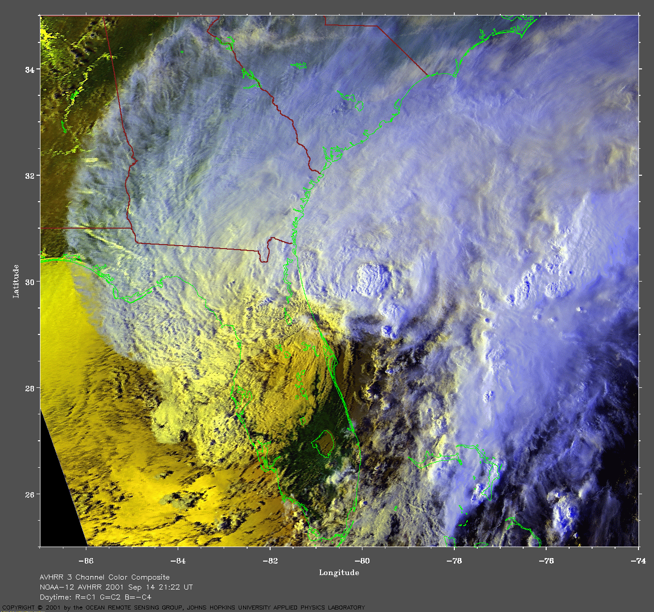
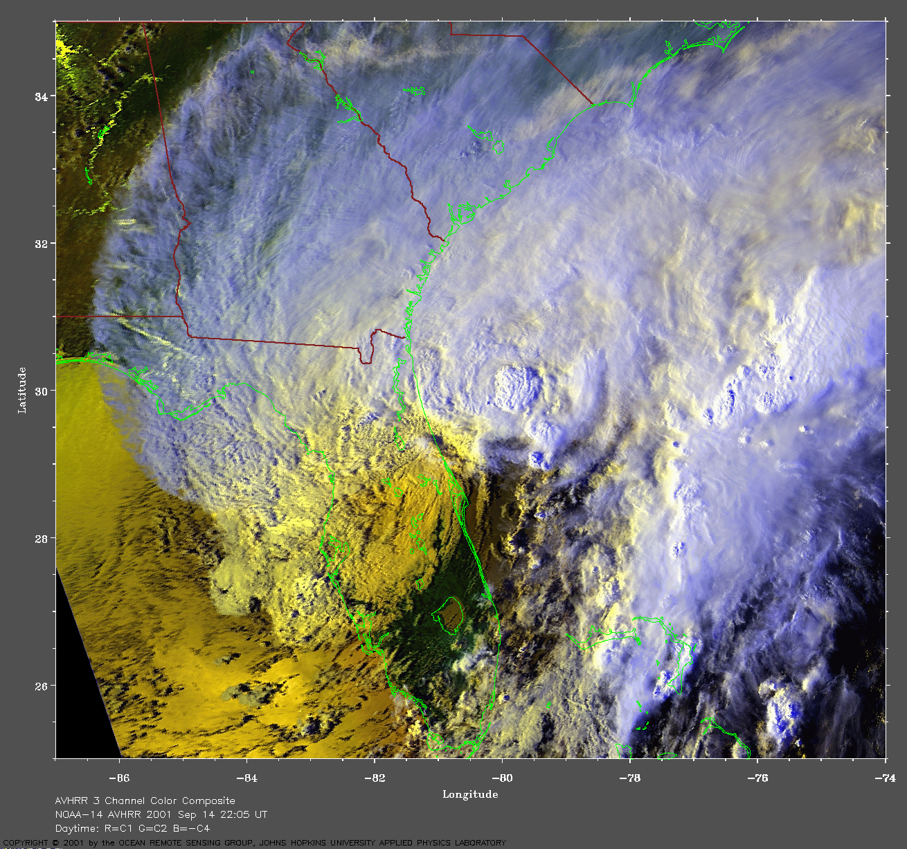
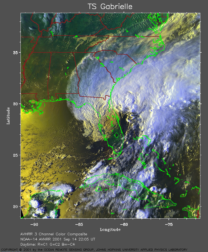 2001 September 14 22:05 UT
NOAA-14 satellite AVHRR 3 channel color composite evening image.
A closer view (451 Kb) is seen by clicking on this small image.
A very large image
(900 Kb) is also available.
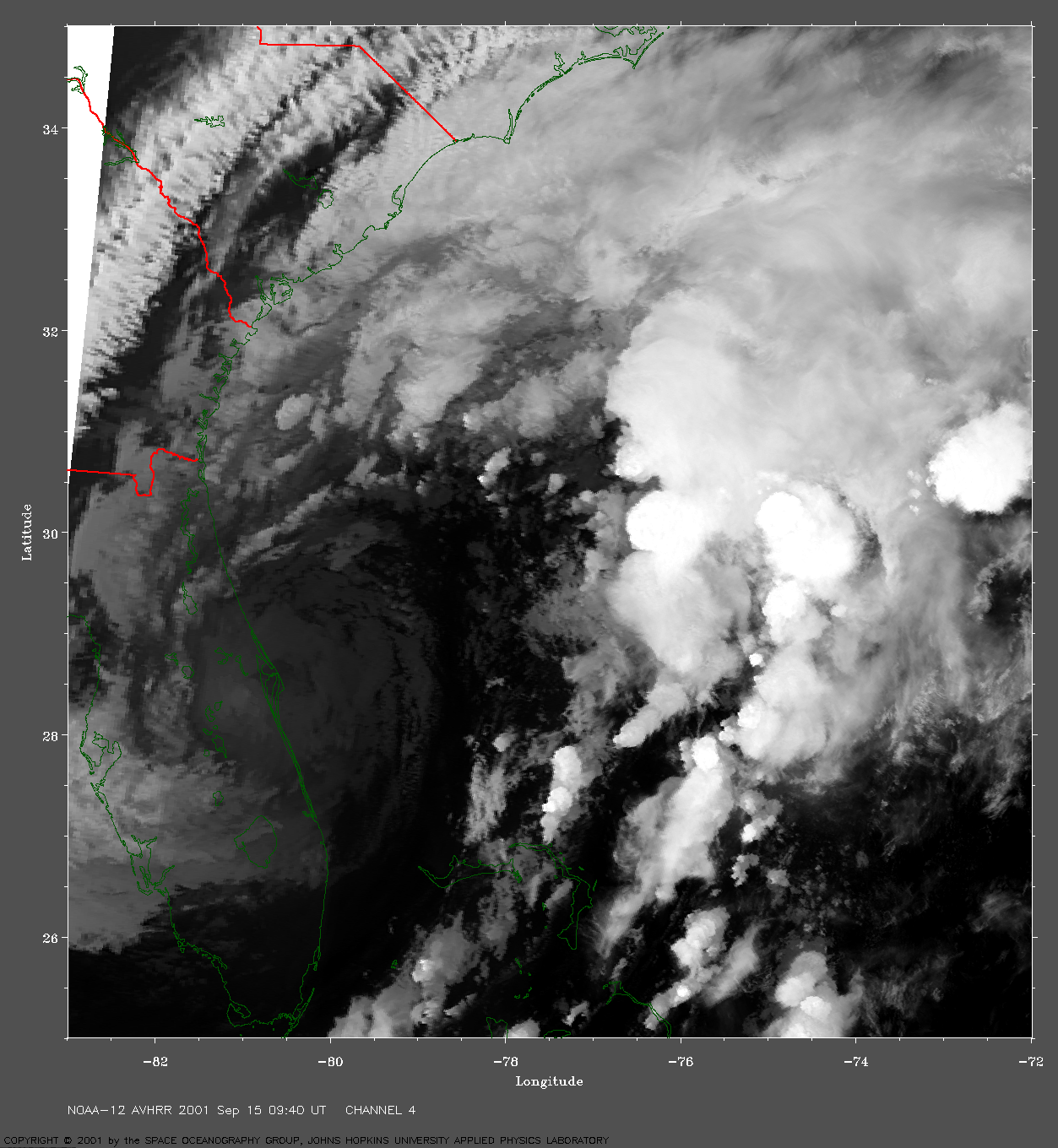
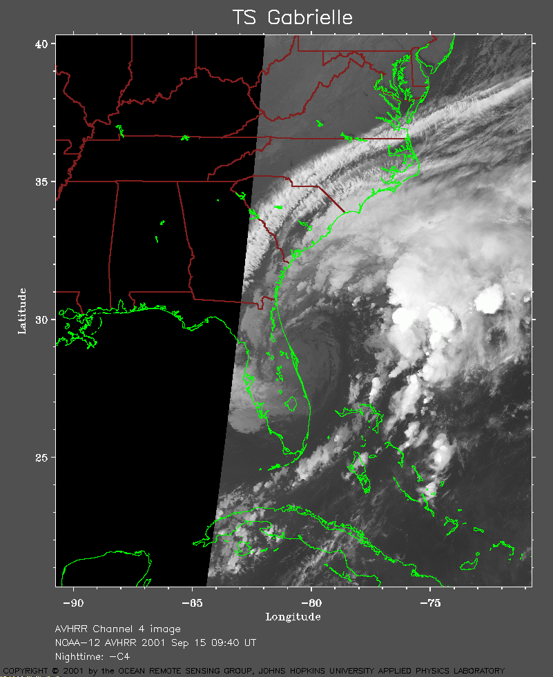 2001 September 15 09:40 UT
NOAA-12 satellite AVHRR channel 4 early morning image.
A closer view (201 Kb) is seen by clicking on this small image.
A very large image
(909 Kb) is also available.
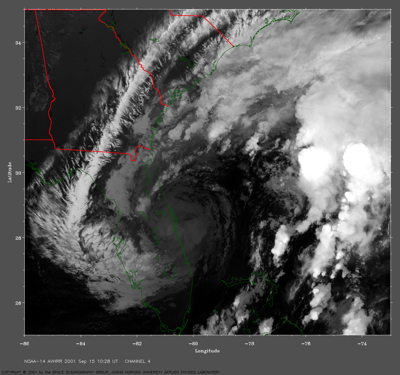
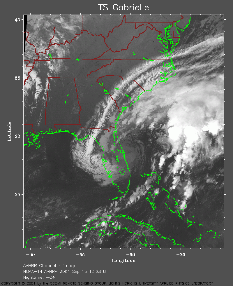 2001 September 15 10:28 UT
NOAA-14 satellite AVHRR channel 4 early morning image.
A closer view (294 Kb) is seen by clicking on this small image.
A very large image
(1095 Kb) is also available.
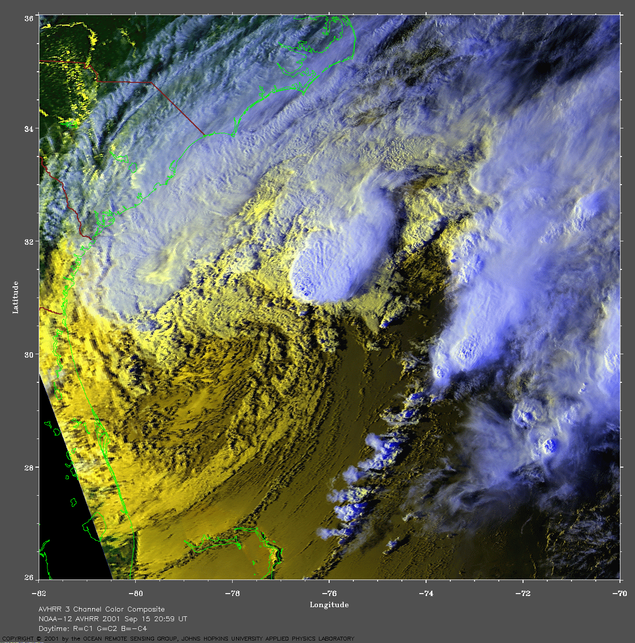
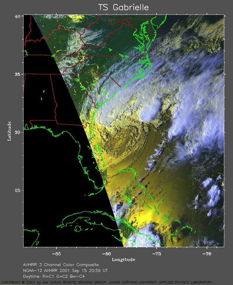 2001 September 15 20:59 UT
NOAA-12 satellite AVHRR 3 channel color composite afternoon image.
A closer view (318 Kb) is seen by clicking on this small image.
A very large image
(996 Kb) is also available.
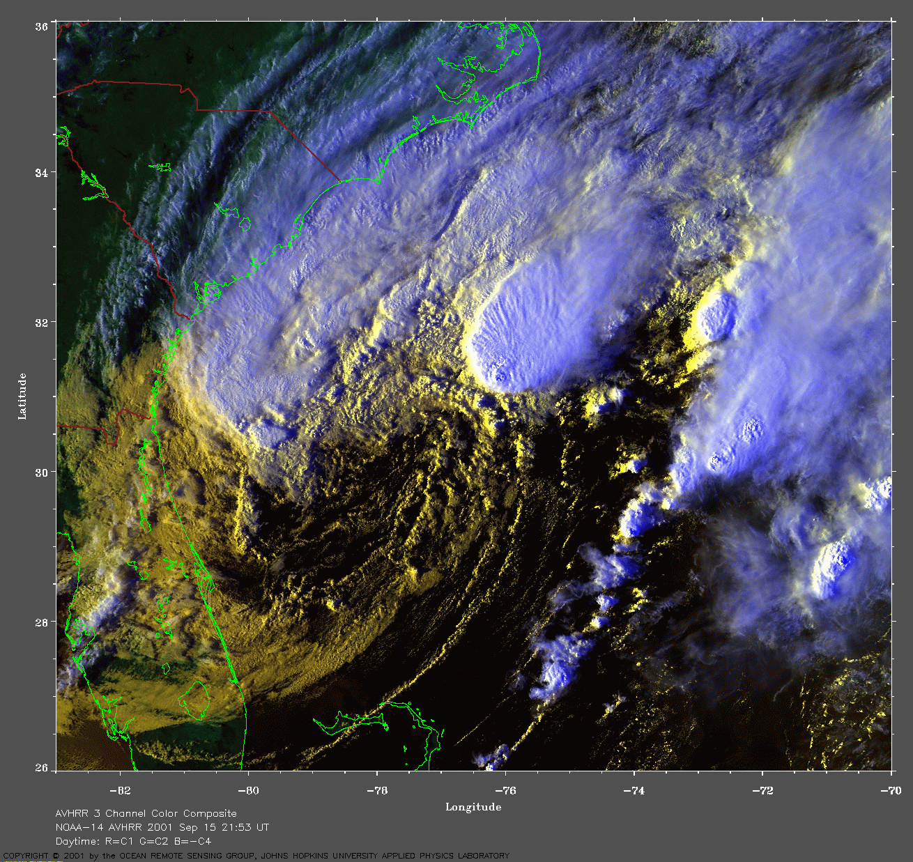
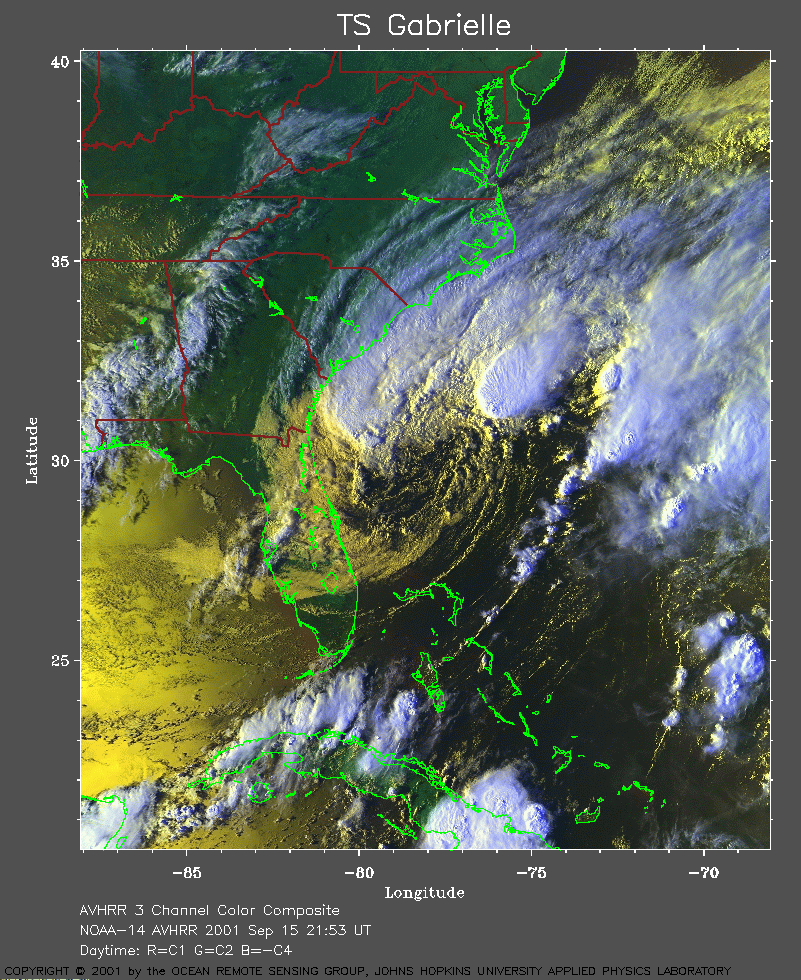 2001 September 15 21:53 UT
NOAA-14 satellite AVHRR 3 channel color composite evening image.
A closer view (450 Kb) is seen by clicking on this small image.
The maximum sustained winds increased to 50 mph at 21:00 UT.
A very large image
(882 Kb) is also available.
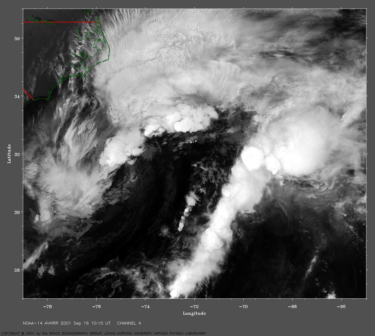
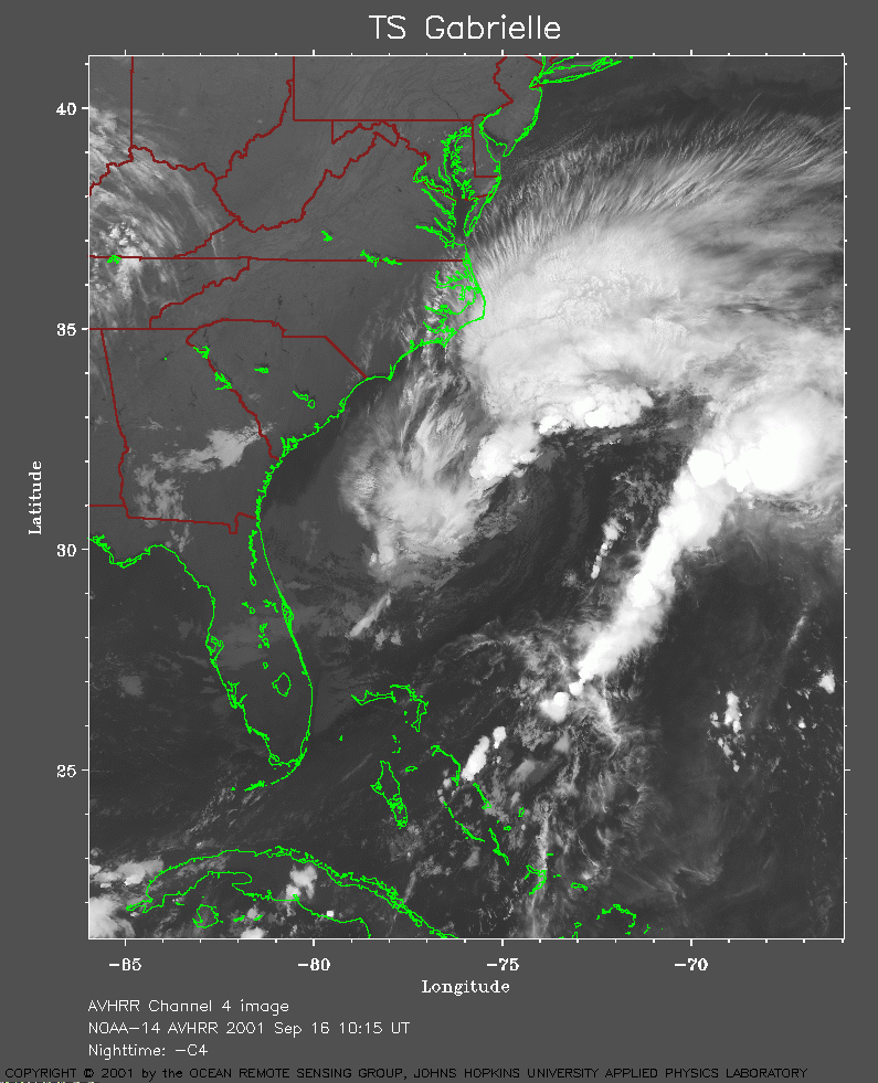 2001 September 16 10:15 UT
NOAA-14 satellite AVHRR channel 4 morning image.
A closer view (280 Kb) is seen by clicking on this small image.
The maximum sustained winds increased to 60 mph at 03:00 UT.
A very large image
(1086 Kb) is also available.
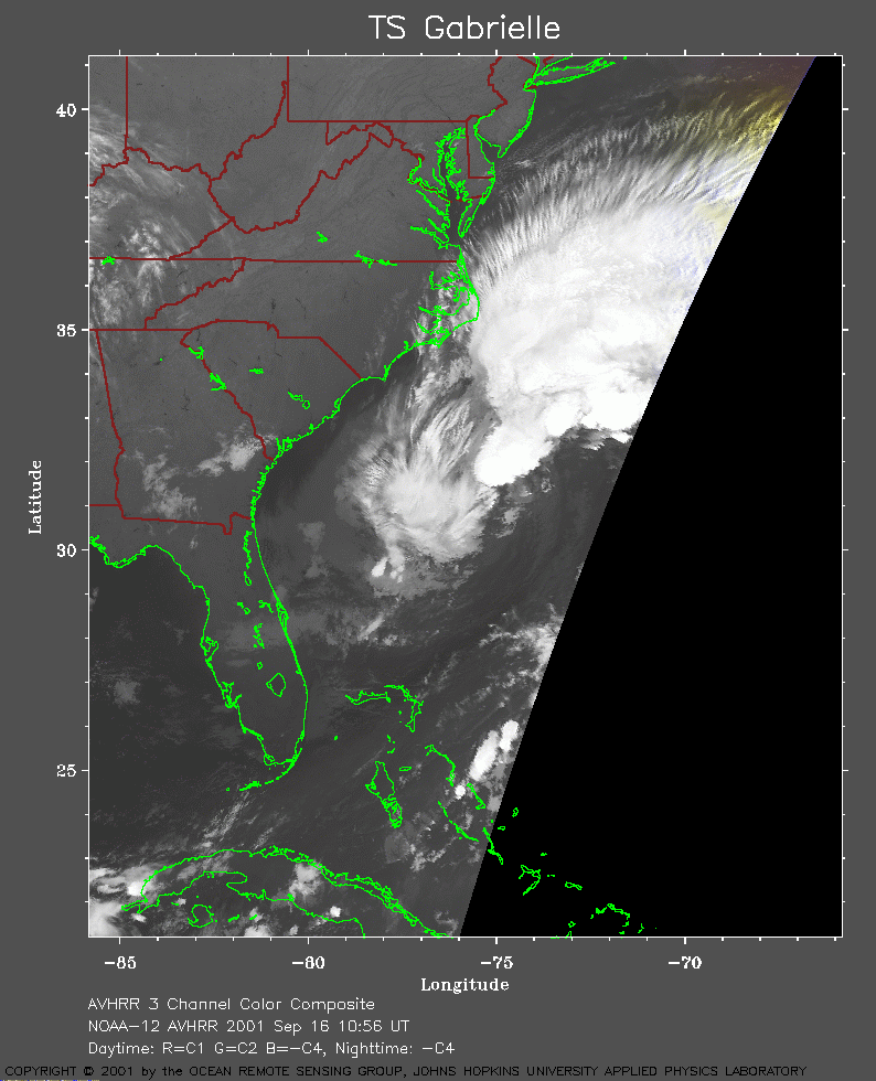 2001 September 16 10:56 UT
NOAA-12 satellite AVHRR channel 4 morning image.
A closer view (177 Kb) is seen by clicking on this small image.
A very large image
(750 Kb) is also available.
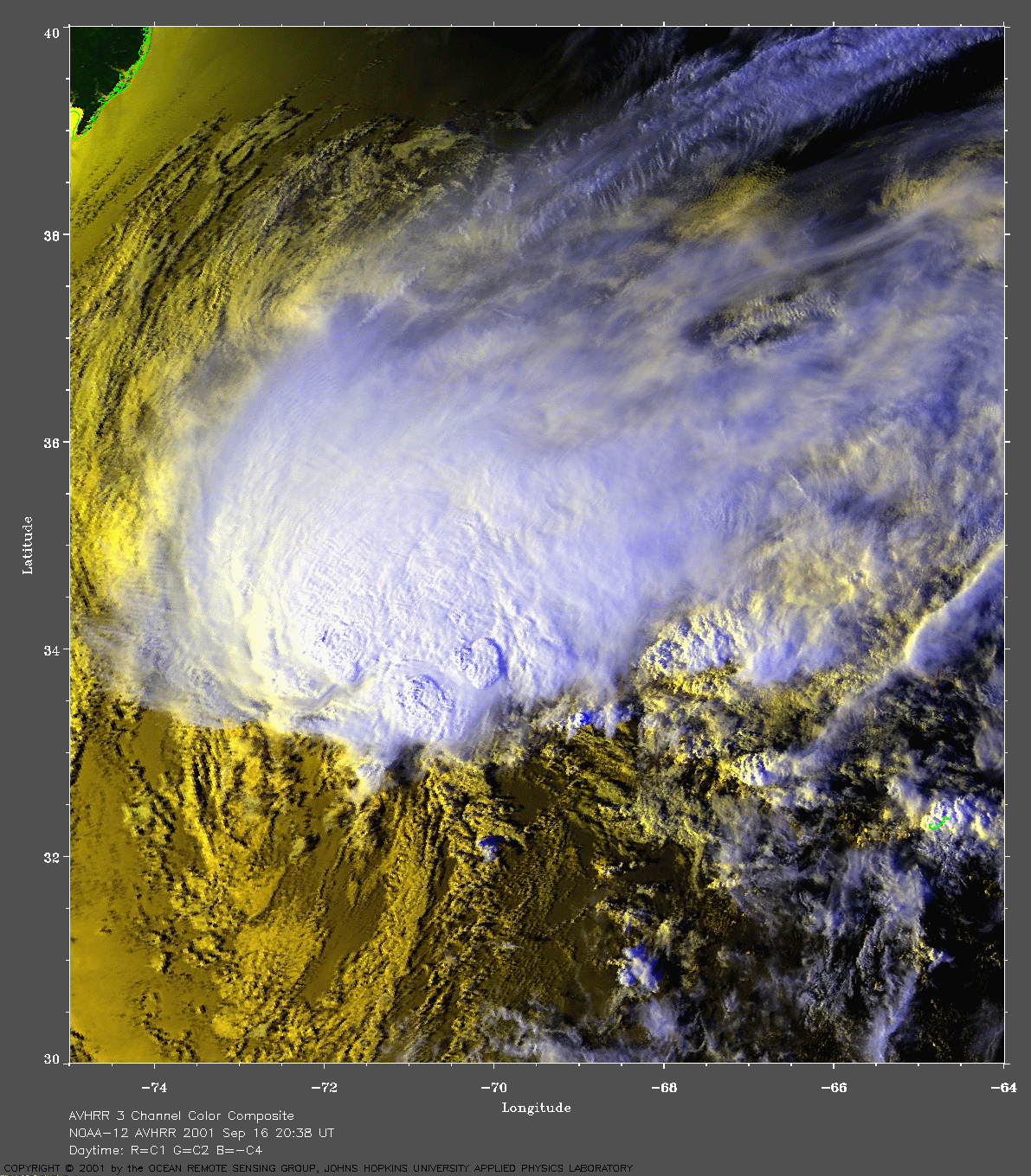
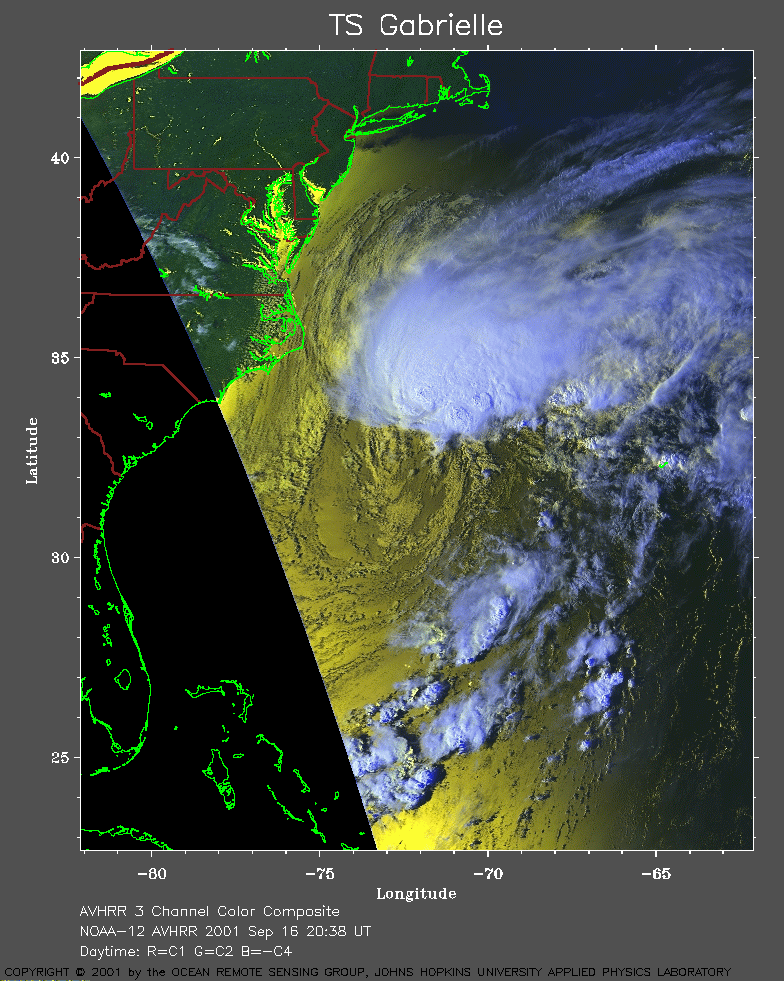 2001 September 16 20:38 UT
NOAA-12 satellite AVHRR 3 channel color composite afternoon image.
A closer view (303 Kb) is seen by clicking on this small image.
The maximum sustained winds increased to 65 mph at 15:00 UT.
A very large image
(889 Kb) is also available.
Note the coast of southern New
Jersey in the northwest corner of the image.
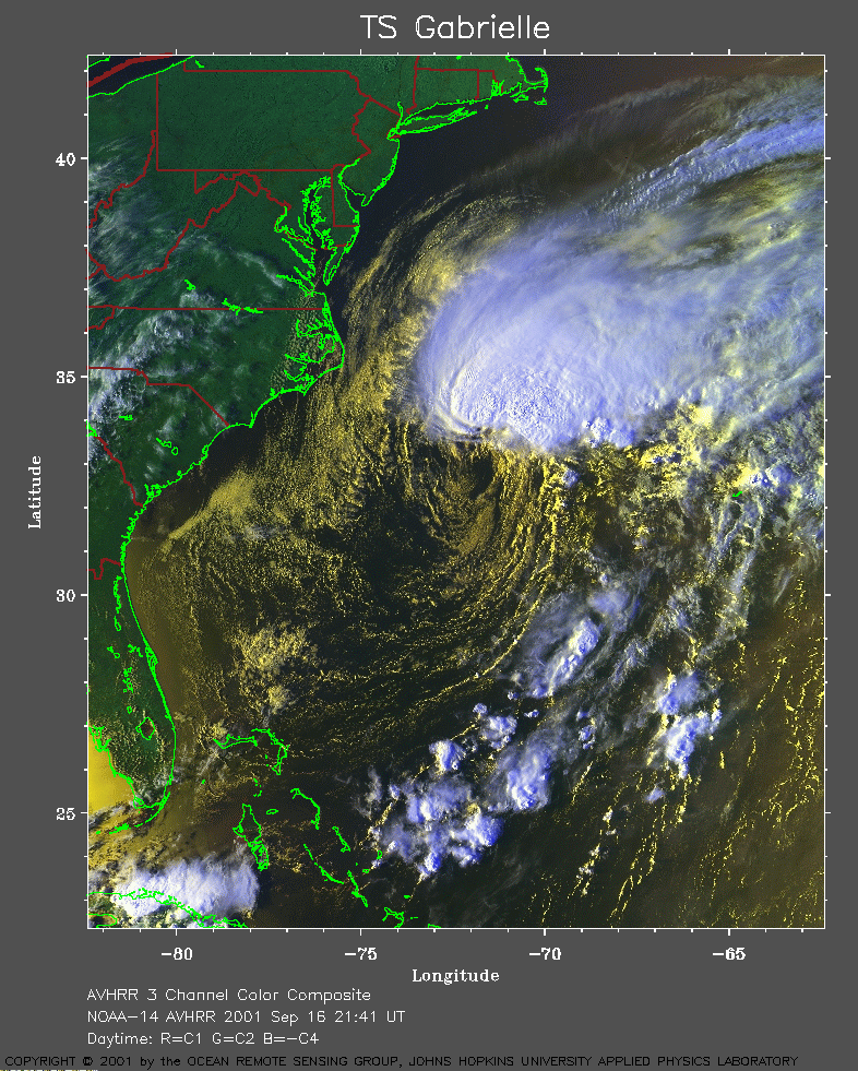 2001 September 16 21:41 UT
NOAA-14 satellite AVHRR 3 channel color composite evening image.
A closer view (414 Kb) is seen by clicking on this small image.
A very large image
(894 Kb) is also available.
Note the coast of southern New
Jersey in the northwest corner of the image.
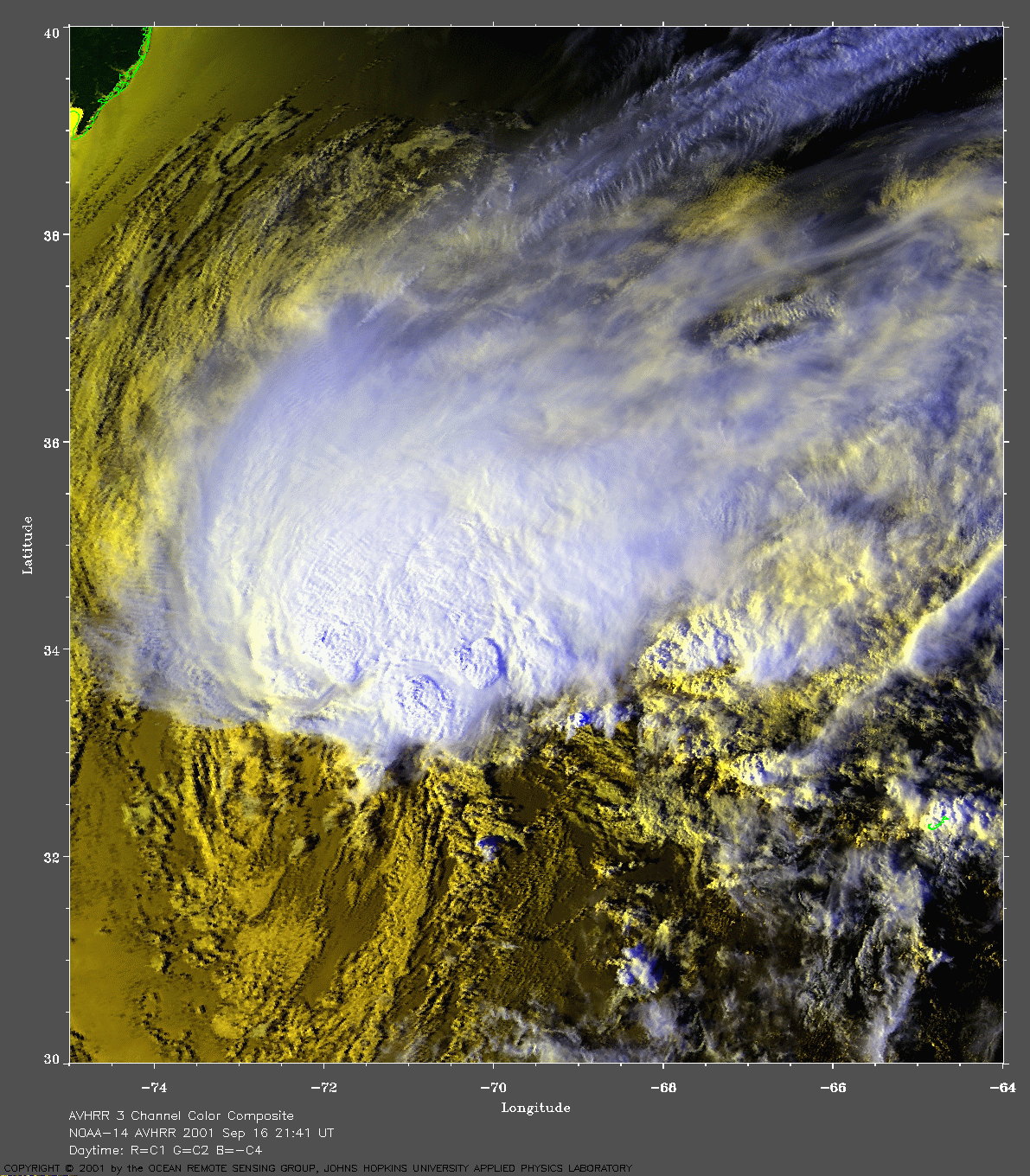
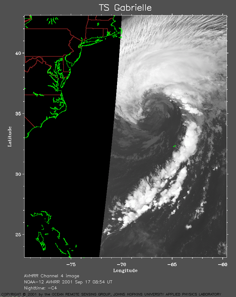 2001 September 17 08:54 UT
NOAA-12 satellite AVHRR channel 4 early morning image.
A closer view (176 Kb) is seen by clicking on this small image.
The maximum sustained winds increased to 75 mph at 03:00 UT.
A very large image
(869 Kb) is also available.
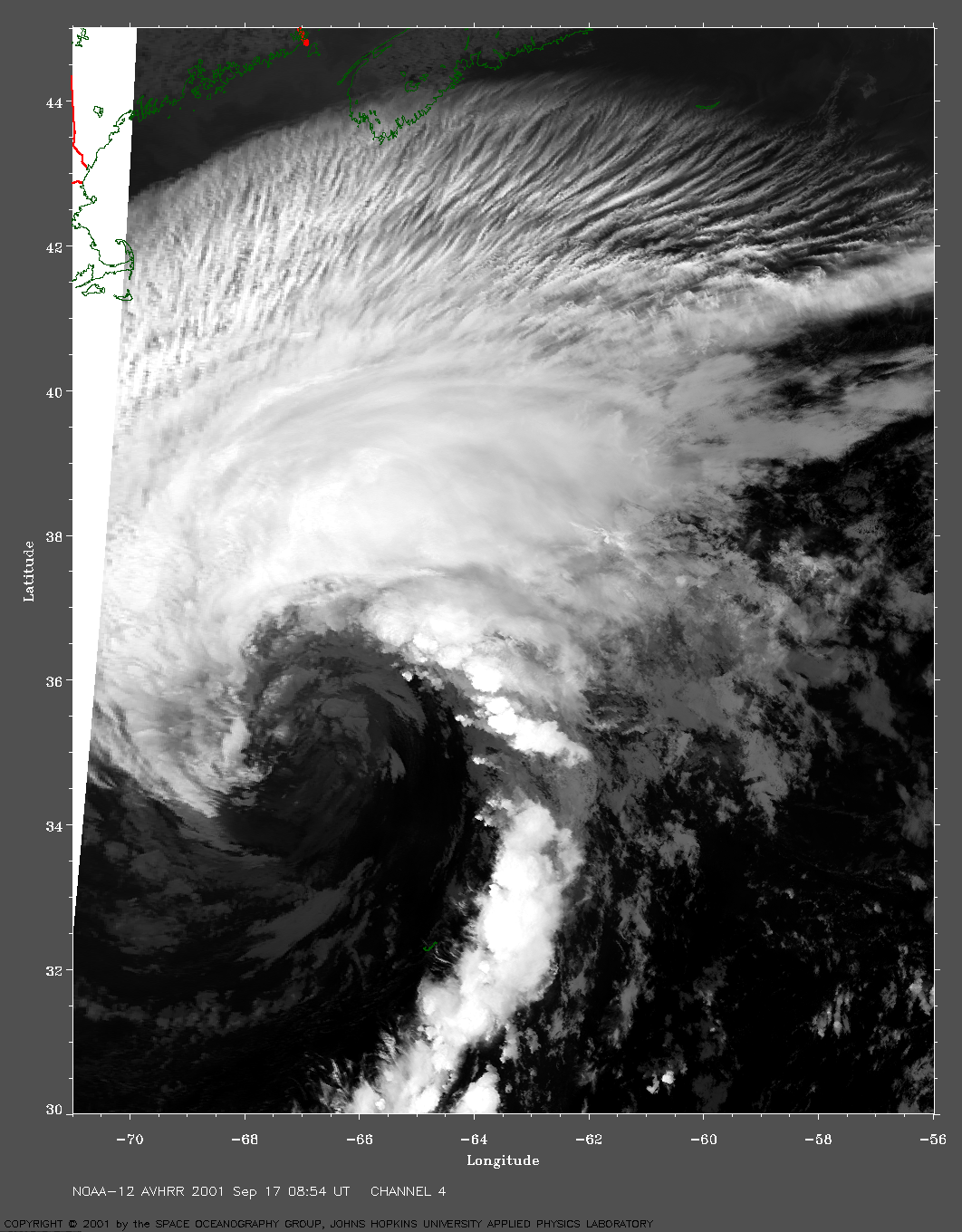
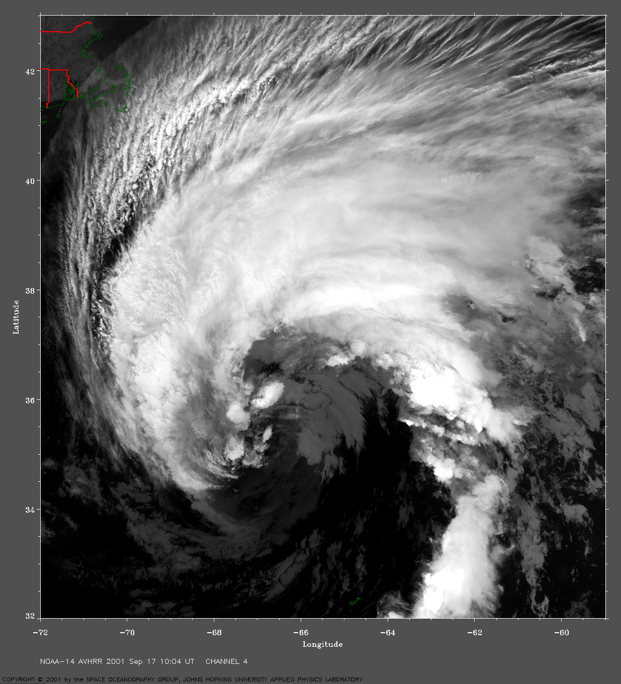
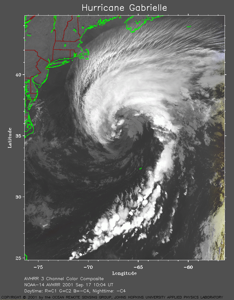 2001 September 17 10:04 UT
NOAA-14 satellite AVHRR channel 4 morning image.
A closer view (310 Kb) is seen by clicking on this small image.
A very large image
(1214 Kb) is also available.
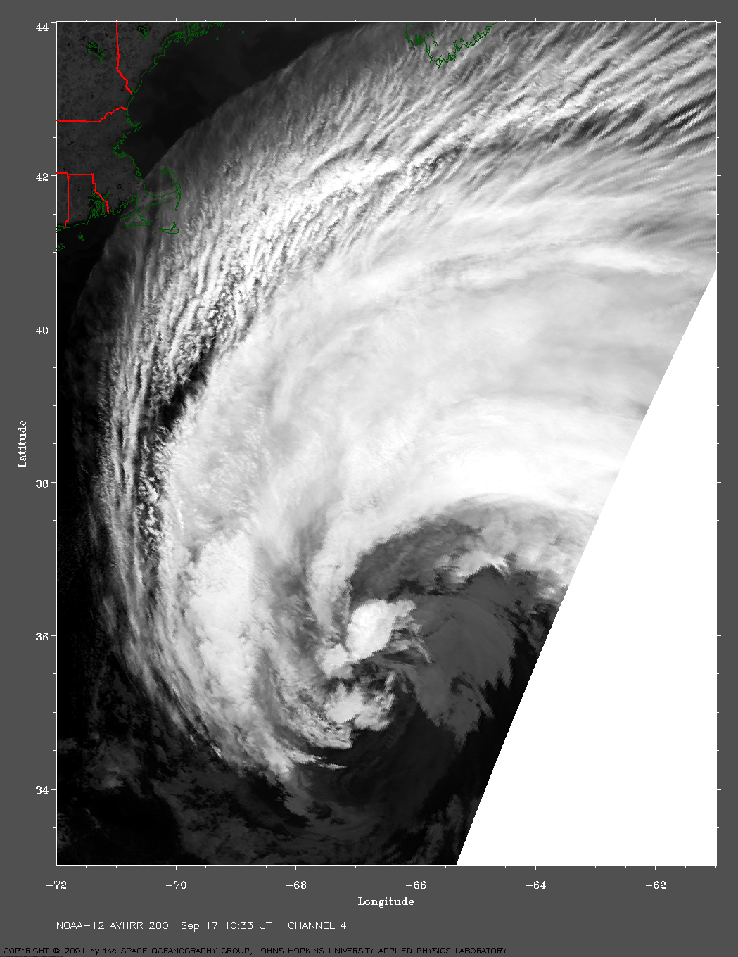
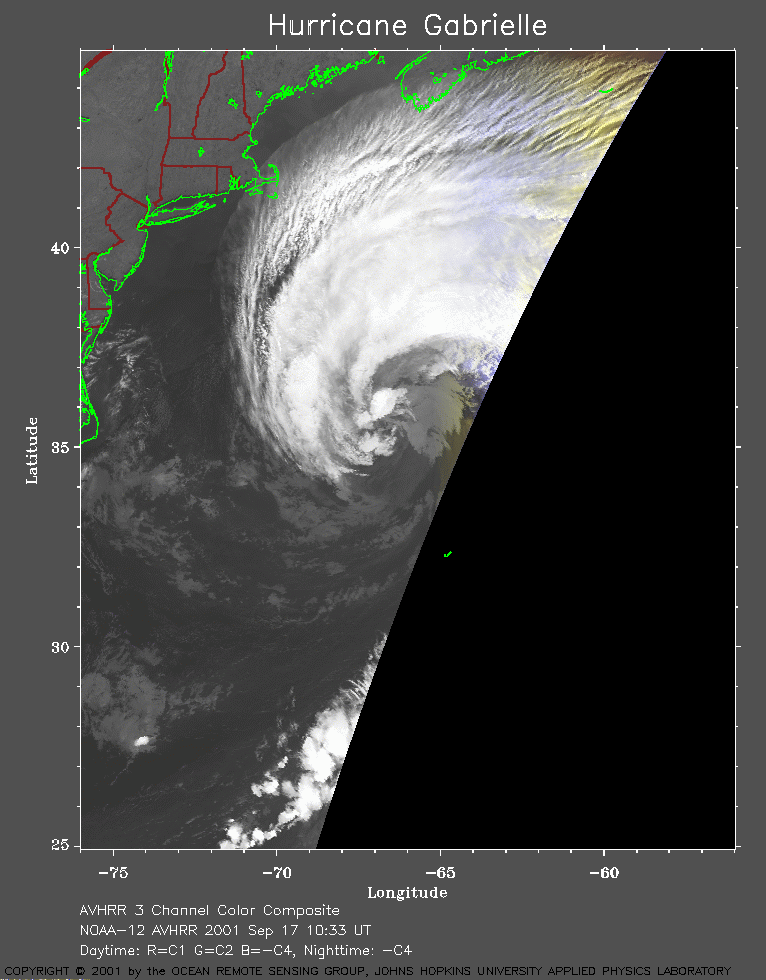 2001 September 17 10:33 UT
NOAA-12 satellite AVHRR channel 4 morning image.
A closer view (172 Kb) is seen by clicking on this small image.
A very large image
(724 Kb) is also available.
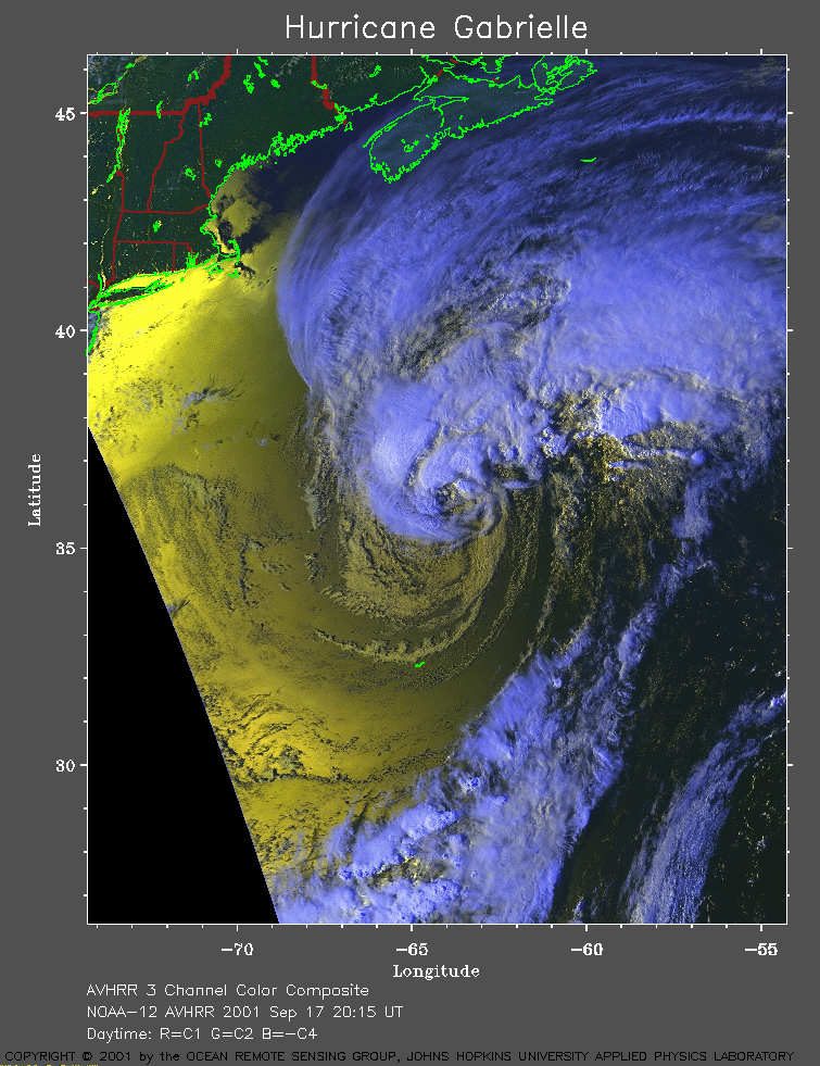 2001 September 17 20:15 UT
NOAA-12 satellite AVHRR 3 channel color composite afternoon image.
A closer view (341 Kb) is seen by clicking on this small image.
The maximum sustained winds increased to 80 mph at 12:00 UT.
A very large image
(1004 Kb) is also available.
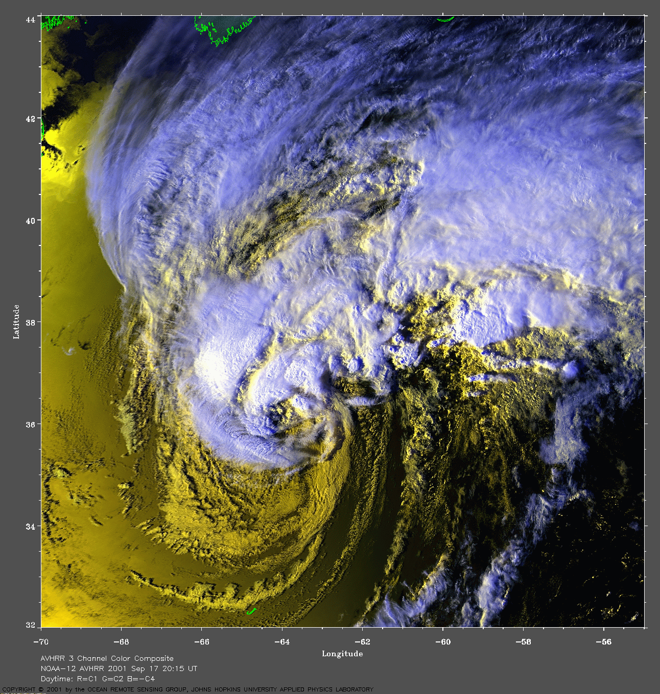
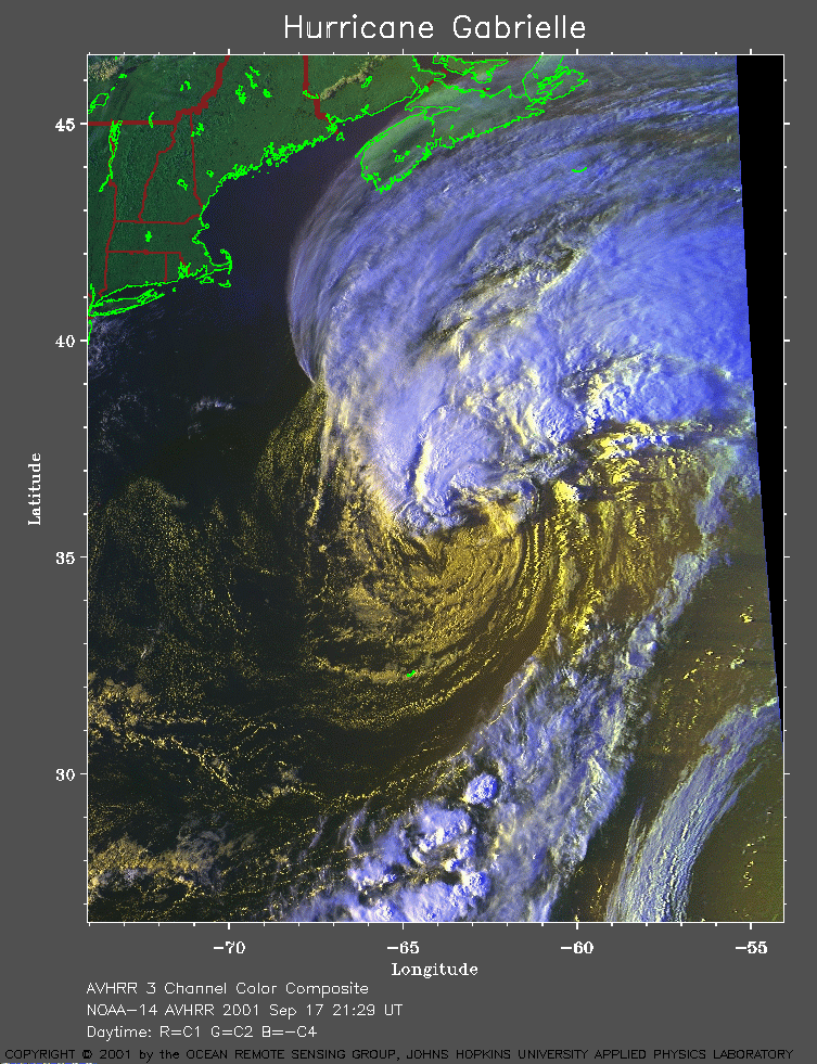 2001 September 17 21:29 UT
NOAA-14 satellite AVHRR 3 channel color composite evening image.
A closer view (375 Kb) is seen by clicking on this small image.
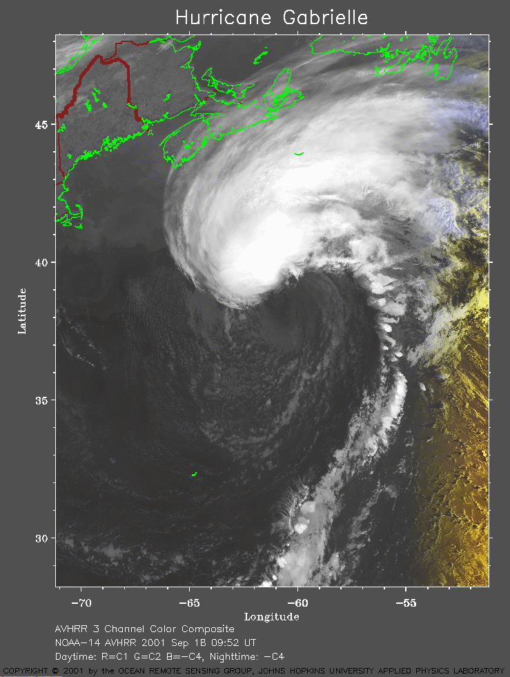 2001 September 18 09:52 UT
NOAA-14 satellite AVHRR channel 4 early morning image.
A closer view (248 Kb) is seen by clicking on this small image.
The maximum sustained winds decreased to 65 mph at 03:00 UT.
A very large image
(1138 Kb) is also available.
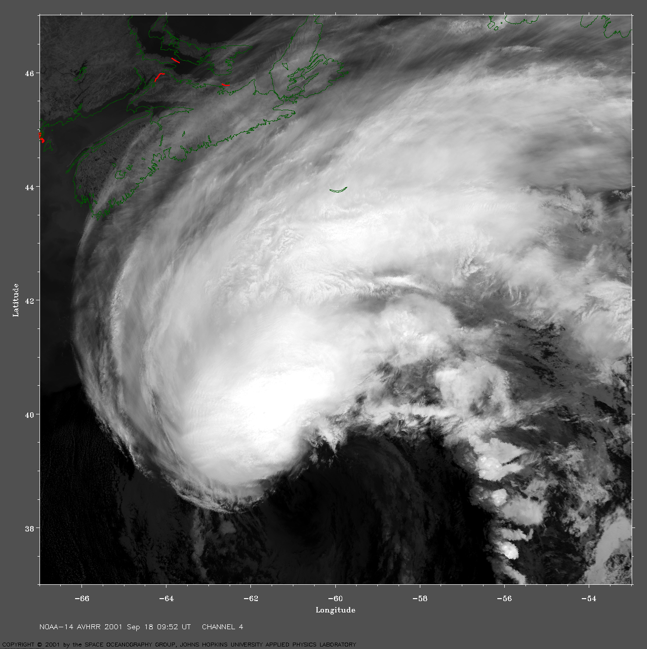
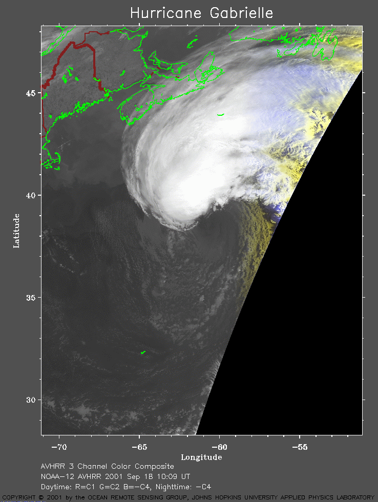 2001 September 18 10:09 UT
NOAA-12 satellite AVHRR channel 4 morning image.
A closer view (177 Kb) is seen by clicking on this small image.
A very large image
(725 Kb) is also available.
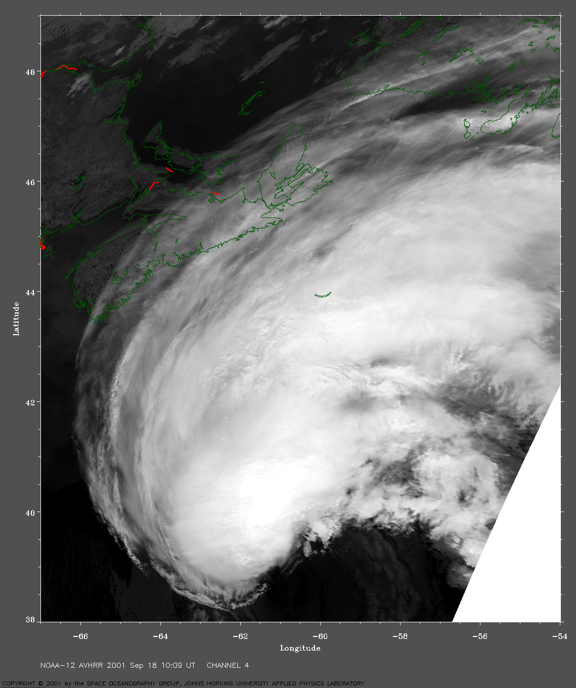
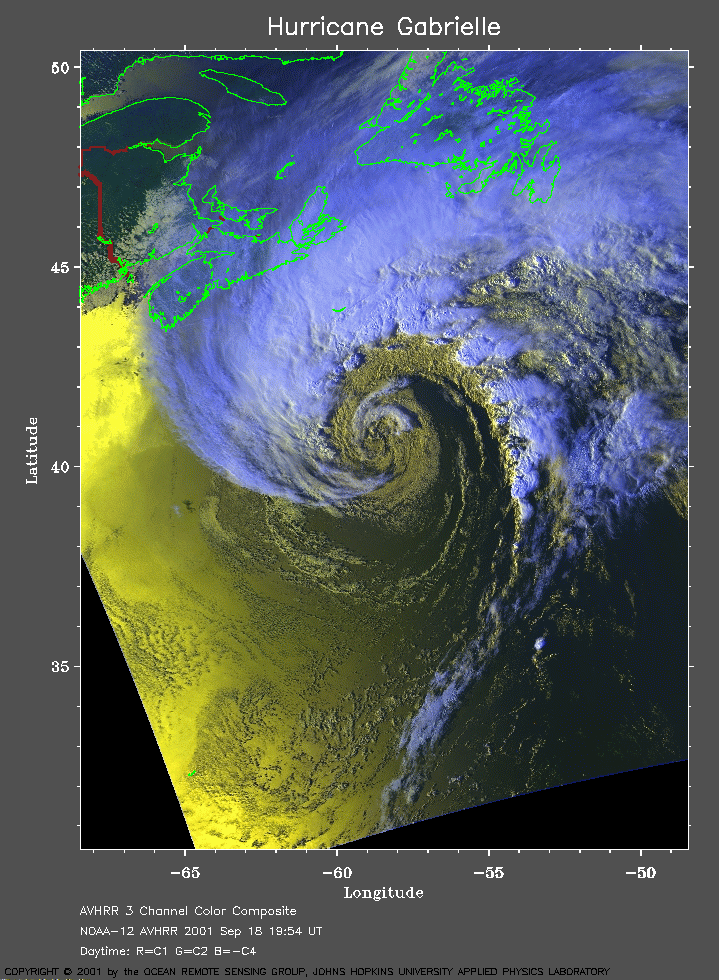 2001 September 18 19:54 UT
NOAA-12 satellite AVHRR 3 channel color composite afternoon image.
A closer view (331 Kb) is seen by clicking on this small image.
A very large image
(954 Kb) is also available.
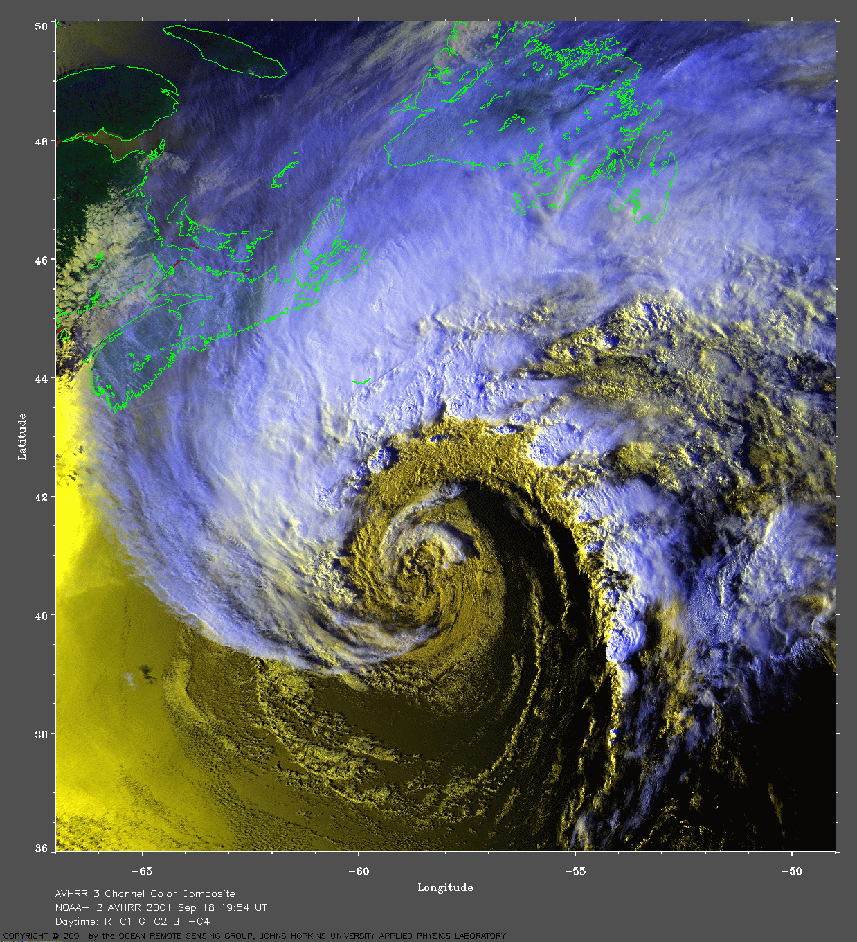