Track maps
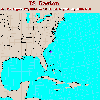
Gaston developed from Tropical Depression Seven off the coast of South
Carolina. After weakening over land (to the point where its position was
no lonager tracked by NHC, Gaston re-formed as a tropical storm
in the Chesapeake Bay (hence the gap in the track).
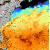
 Gaston track on SST image of the Atlantic Ocean from 26 August (254 Kb)
This image represents the average composite sea surface temperature (SST)
derived from NOAA satellite AVHRR data over the 7 days ending 26 August 2004.
The averaging is done to remove clouds. The temperature scale for SST is 22C to 32C. The track of Gaston is overlaid on this image.
Track file
Track data (lat/lon, winds, etc.) in a text file.

