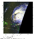
 2009 August 20 14:13 UT
NOAA-17 satellite AVHRR 3 channel color composite morning image.
A closer view (224 Kb) is seen by clicking on this small image.
The maximum sustained winds are 125 mph.
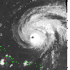 2009 August 21 01:33 UT
NOAA-17 satellite AVHRR channel 4 nighttime image.
A closer view (276 Kb) is seen by clicking on this small image.
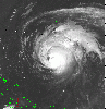 2009 August 21 09:16 UT
NOAA-15 satellite AVHRR channel 4 nighttime image.
A closer view (258 Kb) is seen by clicking on this small image.
The maximum sustained winds have decreased to 120 mph.
 2009 August 21 13:50 UT
NOAA-17 satellite AVHRR 3 channel color composite daytime image.
A closer view (297 Kb) is seen by clicking on this small image.
The maximum sustained winds have decreased to 115 mph.
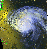 2009 August 21 20:35 UT
NOAA-15 satellite AVHRR 3 channel color composite daytime image.
A closer view (340 Kb) is seen by clicking on this small image.
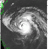 2009 August 22 01:10 UT
NOAA-17 satellite AVHRR channel 4 nighttime image.
A closer view (252 Kb) is seen by clicking on this small image.
The maximum sustained winds have decreased to 105 mph.
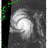 2009 August 22 08:52 UT
NOAA-15 satellite AVHRR channel 4 nighttime image.
A closer view (212 Kb) is seen by clicking on this small image.
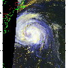 2009 August 22 13:27 UT
NOAA-17 satellite AVHRR 3 channel color composite daytime image.
A closer view (249 Kb) is seen by clicking on this small image.
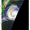 2009 August 22 15:06 UT
NOAA-17 satellite AVHRR 3 channel color composite daytime image.
A closer view (201 Kb) is seen by clicking on this small image.
The maximum sustained winds have decreased to 100 mph.
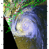 2009 August 22 20:12 UT
NOAA-15 satellite AVHRR 3 channel color composite daytime image.
A closer view (298 Kb) is seen by clicking on this small image.
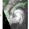 2009 August 23 00:47 UT
NOAA-17 satellite AVHRR channel 4 nighttime image.
A closer view (236 Kb) is seen by clicking on this small image.
The maximum sustained winds have decreased to 85 mph.
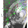 2009 August 23 10:08 UT
NOAA-15 satellite AVHRR 3 channel color composite early morning image.
A closer view (259 Kb) is seen by clicking on this small image.
 2009 August 23 14:43 UT
NOAA-17 satellite AVHRR 3 channel color composite daytime image.
A closer view (299 Kb) is seen by clicking on this small image.
 2009 August 23 19:50 UT
NOAA-15 satellite AVHRR 3 channel color composite daytime image.
A closer view (292 Kb) is seen by clicking on this small image.
The maximum sustained winds have decreased to 80 mph.
 2009 August 24 00:25 UT
NOAA-17 satellite AVHRR channel 4 nighttime image.
A closer view (219 Kb) is seen by clicking on this small image.
The maximum sustained winds have decreased to 75 mph.