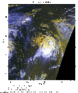
 2010 September 18 12:44 UT
NOAA-17 satellite AVHRR 3 channel color composite daytime image.
A closer view (333 Kb) is seen by clicking on this small image.
Julia has weakened to a tropical storm with maximum sustained winds of 60 mph.
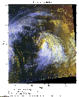
 2010 September 18 17:44 UT
NOAA-18 satellite AVHRR 3 channel color composite daytime image.
A closer view (278 Kb) is seen by clicking on this small image.
The maximum sustained winds have decreased to 50 mph.
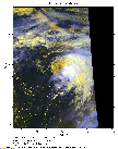
 2010 September 18 20:02 UT
NOAA-18 satellite AVHRR 3 channel color composite daytime image.
A closer view (342 Kb) is seen by clicking on this small image.
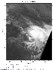
 2010 September 19 00:04 UT
NOAA-17 satellite AVHRR channel 4 nighttime image.
A closer view (268 Kb) is seen by clicking on this small image.
 2010 September 19 06:08 UT
NOAA-18 satellite AVHRR channel 4 nighttime image.
A closer view (269 Kb) is seen by clicking on this small image.
 2010 September 19 12:21 UT
NOAA-17 satellite AVHRR 3 channel color composite daytime image.
A closer view (348 Kb) is seen by clicking on this small image.
The outer cloud bands of Igor are seen to the left of Julia.
 2010 September 19 17:34 UT
NOAA-18 satellite AVHRR 3 channel color composite daytime image.
A closer view (280 Kb) is seen by clicking on this small image.
 2010 September 19 19:40 UT
NOAA-15 satellite AVHRR 3 channel color composite daytime image.
A closer view (317 Kb) is seen by clicking on this small image.
 2010 September 19 23:42 UT
NOAA-17 satellite AVHRR channel 4 nighttime image.
A closer view (237 Kb) is seen by clicking on this small image.
The maximum sustained winds have decreased to 45 mph.
 2010 September 20 05:58 UT
NOAA-18 satellite AVHRR channel 4 nighttime image.
A closer view (230 Kb) is seen by clicking on this small image.