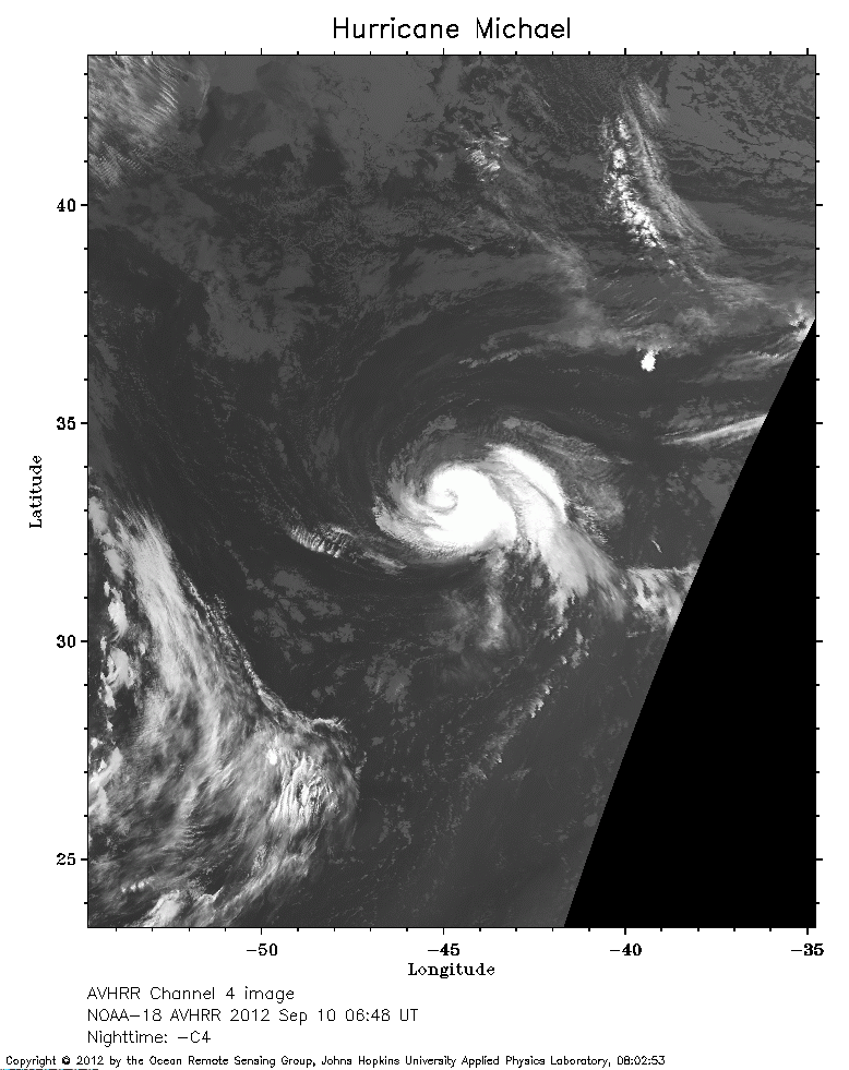
 2012 September 10 06:48 UT
NOAA-18 satellite AVHRR channel 4 nighttime image.
A closer view (232 Kb) is seen by clicking on this small image.
The maximum sustained winds are 85 mph.
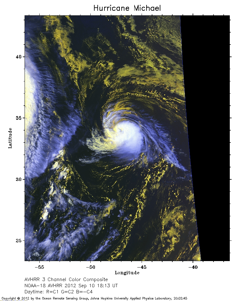 2012 September 10 18:13 UT
NOAA-18 satellite AVHRR 3 channel color composite daytime image.
A closer view (285 Kb) is seen by clicking on this small image.
The maximum sustained winds have decreased to 80 mph. To the west of Michael is seen the eastern edge of the much larger Leslie.
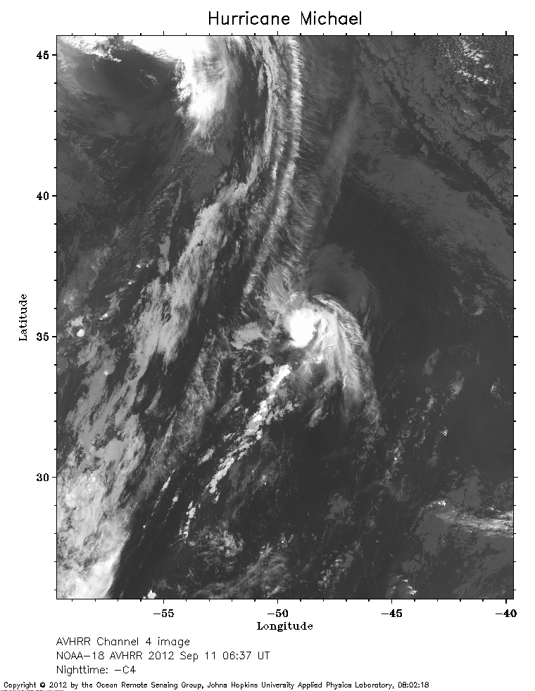 2012 September 11 06:37 UT
NOAA-18 satellite AVHRR channel 4 nighttime image.
A closer view (263 Kb) is seen by clicking on this small image.
The maximum sustained winds have decreased to 75 mph.
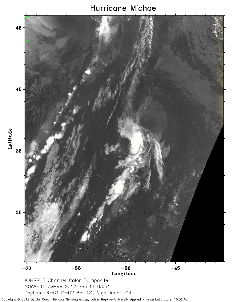 2012 September 11 08:51 UT
NOAA-15 satellite AVHRR channel 4 nighttime image.
A closer view (280 Kb) is seen by clicking on this small image.
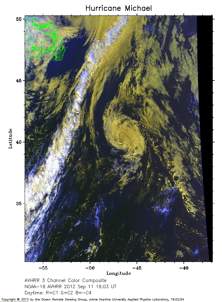 2012 September 11 18:03 UT
NOAA-18 satellite AVHRR 3 channel color composite daytime image.
A closer view (309 Kb) is seen by clicking on this small image.
The maximum sustained winds have decreased to 45 mph.
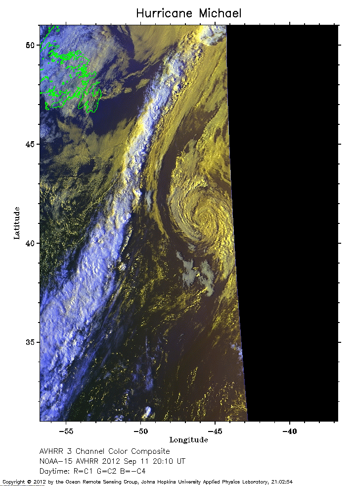 2012 September 11 20:10 UT
NOAA-15 satellite AVHRR 3 channel color composite daytime image.
A closer view (246 Kb) is seen by clicking on this small image.