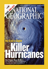
Atlantic Hurricane Track Maps & Imagesby Steven Babin and Ray Sterner The Johns Hopkins University Applied Physics Laboratory
These pages are strictly for non-profit educational use that is not of a commercial nature. These webpages average over 1.2 million hits per year. |
|---|
2016 Atlantic Hurricane Season Track Maps & Satellite Images
2015 Atlantic Hurricane Season Track Maps & Satellite Images
2014 Atlantic Hurricane Season Track Maps & Satellite Images
2013 Atlantic Hurricane Season Track Maps & Satellite Images
2012 Atlantic Hurricane Season Track Maps & Satellite Images
2011 Atlantic Hurricane Season Track Maps & Satellite Images
2010 Atlantic Hurricane Season Track Maps & Satellite Images
2009 Atlantic Hurricane Season Track Maps & Satellite Images
2008 Atlantic Hurricane Season Track Maps & Satellite Images
2007 Atlantic Hurricane Season Track Maps & Satellite Images
2006 Atlantic Hurricane Season Track Maps & Satellite Images
2005 Atlantic Hurricane Season Track Maps & Satellite Images
2004 Atlantic Hurricane Season Track Maps & Satellite Images
2003 Atlantic Hurricane Season Track Maps & Satellite Images
2002 Atlantic Hurricane Season Track Maps & Satellite Images
2001 Atlantic Hurricane Season Track Maps & Satellite Images
2000 Atlantic Hurricane Season Track Maps & Satellite Images
1999 Atlantic Hurricane Season Track Maps & Satellite Images
1998 Atlantic Hurricane Season Track Maps & Satellite Images
1997 Atlantic Hurricane Season Track Maps & Satellite Images
1996 Atlantic Hurricane Season Track Maps & Satellite Images
1995 Atlantic Hurricane Season Track Maps
Track Maps For Selected Earlier Atlantic
Hurricanes
(includes the 1991 "Perfect Storm")
Atlantic Tropical Activity Summary, 1967-2015 (48 Kb)
National Hurricane Center Active Storm Advisories
Real-time GOES satellite images: National Hurricane Center U. Wisconsin
Hurricanes, Typhoons, & Tropical Cyclones FAQs (NOAA)
Federal Emergency Management Agency Homepage
Your own Atlantic Hurricane Tracking
Chart for Downloading (51 Kb)
Larger version of your own Atlantic
Hurricane Tracking Chart for Downloading (952 Kb)

Page contacts: Dr. Steven Babin, Ray Sterner
Copyright 1994-2015 by Steven Babin, Ray Sterner, and The Johns Hopkins University Applied Physics Laboratory, all rights reserved.
