NOAA 14 AVHRR views of the Flooding in California in early January 1997


|
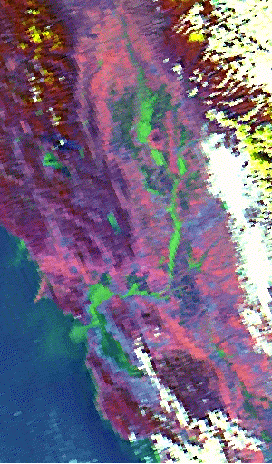
Sacramento Valley, California on Jan 5, 1997
2:45 PM PST (2045 UT) This image shows clear skies over California's San Joaquin and Sacramento valleys. Sutter Buttes are seen as the small blue circle in both images (before and after flood) of the Sacramento valley almost halfway between Sacramento and Redding. After many days of successive Pacific storms brought rain and snow to the area, the clouds have cleared except over the Sierra Nevada. The melted snow and heavy rain have caused flooding in many areas in California. In this image, we see that the swollen Sacramento and Feather Rivers (green) are clearly outside their banks. Notice the green plume extending out into the Pacific Ocean from San Francisco Bay. Also notice that there is a crescent shaped green area in front of this plume. This probably represents river discharge during the previous tidal cycle. When the tide came into the Bay, there was a gap created between the first and second plumes. |
|
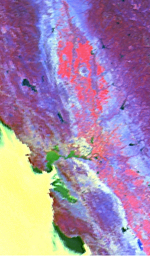
Sacramento Valley, California on Aug 1, 1996
1:47 PM PDT (2047 UT) This image shows the San Joaquin and Sacramento valleys when there was no flooding present (last summer). Compare this image with the one depicting the flooding. This image shows the fertile valleys with their summer crops (red). The rivers in this image are barely visible. The vegetation is more prominent in this image than in the one to the left but some of this effect is probably seasonal. Note the area of fog over the Pacific Ocean extending along the coast. |
|
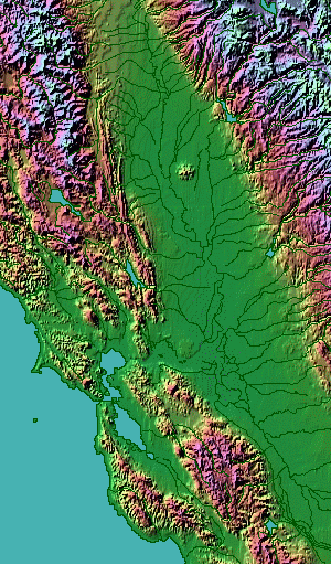
Shaded relief map of Sacramento Valley
This image is a shaded relief map of the area courtesy of Ray Sterner. Use this map to identify geographic features for comparison. Note Sutter Buttes in the Sacramento Valley. |