|
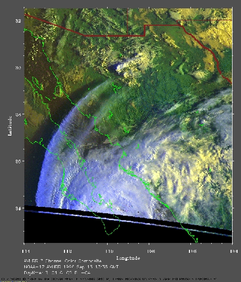
West coast of Mexico on Sep 13, 1996
In this image, the warmer (and lower) clouds are yellow. The cooler (and higher) clouds are white. This image was acquired by the APL ground station at the edge of its detection range. Therefore, there are regions of data loss near the bottom of the image. This includes a line of black dots parallel to the bottom of the visible image. | |
|
Despite these limitations, this image shows the development of cumulonimbus clouds (yellow) over the Sierra Madre Occidental. When the hurricane crosses over land, it loses its source of moisture and weakens. The hurricane force winds experience strong shear interacting with the land below. This shear can lead to the development of tornadoes . Later this storm will produce torrential rains and flooding over Texas. The effects of this system will be eventually felt along the east coast of the U.S. Notice the shadows of the clouds from the low sun angle. From the date and time and the length of the shadows, you can estimate the height of the clouds. Click here for A VERY LARGE image of this storm system (787 Kb). | To return to the index page, click here . |
